Silver, settlement and the history of Gümüşhane
The history of Gümüşhane and the origin of its name begin with silver. Mines near Canca helped shape the settlement that developed into Ottoman Gümüşhane. Later, declining mining activity and the Trabzon–Erzurum road helped pull the centre toward the Harşit River. The name stayed with a city whose centre changed location.
If you visit Gümüşhane today, its older centre lies beyond the present one. Süleymaniye Mahallesi, known as Old Gümüşhane, stands approximately four kilometres to the southwest. That distance matters: the history of the city belongs to both the former mining settlement and the later centre beside the river.
What does the name Gümüşhane mean?
Gümüşhane combines two words from different languages: Turkish gümüş, meaning silver, and Persian hane. The resulting name connects the settlement directly with nearby silver deposits. Silver therefore belongs to both the city’s economic history and the explanation of its name.
Canca is essential to understanding that connection. In the Ottoman census of 1486, the historical core of present-day Gümüşhane appeared within Torul as a village called “karye-yi Palu Canca.” This record places Canca at the centre of the documented settlement story.
Sixteenth-century Ottoman records distinguish Eski Canca from “Karye-i Nefs-i Canca-yı Ma‘den,” a settlement growing near the mines. These were recorded as separate places. If you encounter both Canca and Gümüşhane while reading local history, keep this distinction in mind: the settlement pattern involved more than a single village receiving another name.
Was Argyropolis an ancient name for Gümüşhane?
The provincial culture and tourism directorate states that the city was called Argyropolis during the Byzantine period. It explains the name as “silver city.” In that account, the association between the place and silver reaches back into its Byzantine naming history.
A different account appears in English Wikipedia. It states that Greek-speaking inhabitants also used the name Gümüşhane and that Argyropolis came into use during the first decades of the nineteenth century. These accounts disagree about when Argyropolis became a name for the city. The Byzantine dating should therefore be presented as an attributed claim rather than a settled chronology.
When did Ottoman rule begin?
The date of Ottoman incorporation also differs between accounts. Kültür Portalı connects Süleymaniye’s passage into Ottoman rule with the conquest of Trabzon in 1461. Abdürrahim Pamuk’s study in Belleten instead dates Gümüşhane’s incorporation under Rakkas Sinan Bey to 1479.
The 1486 census provides a later documentary reference. By then, “karye-yi Palu Canca” was recorded within Torul. Keeping the disputed takeover dates separate from this census entry makes the sequence clearer: the sources disagree over the transition, while the village appears explicitly in the subsequent Ottoman record.
How Süleymaniye grew around the mines
Sultan Süleyman ordered a mosque and approximately fifty houses to be built near new silver deposits. This initiative encouraged the development of what is now Süleymaniye Mahallesi. Housing, worship and extraction were brought together around the new mining settlement.
The 1554 census gives a closer view of its population. It records 31 Muslim households and 13 unmarried Muslim men. It also records 113 non-Muslim households and 27 unmarried non-Muslim men. These are separate categories in the register, so the household figures should not be read as a complete count of individual residents.
Sultan Süleyman Han Mosque preserves another part of this history. Information at the building dates its construction to 1520–1566. It was renovated in 1899 and restored in 2004. When you visit Süleymaniye, the mosque connects the district’s Ottoman development with later efforts to maintain its buildings.
Why did the city centre move?
Mining decline and the influence of the Trabzon–Erzurum road helped shift the centre away from the old settlement. The movement was toward Bahçeler, beside the Harşit River. Gümüşhane’s geography thus changed as the importance of the mines weakened and the road influenced urban development.
There is an everyday-life connection here. Where you live often depends on access to work and transport. Gümüşhane’s move toward Bahçeler gives that familiar relationship a historical setting: the earlier settlement developed near silver deposits, while the later centre grew under the influence of a major road.
Timeline
- 1461 / 1479: Sources give different dates for Ottoman incorporation. Kültür Portalı gives 1461; the Belleten study gives 1479.
- 1486: An Ottoman census records “karye-yi Palu Canca” within Torul.
- 1520–1566: Information at Sultan Süleyman Han Mosque dates its construction to this period.
- 1554: The census records Muslim and non-Muslim households, alongside unmarried men.
- 1647: Evliya Çelebi visits and describes approximately seventy silver workings, some closed.
- 1718: Gümüşhane appears as the minting location on local coins.
- 1757–1774: Attempts to work flooded mines fail during Mustafa III’s reign.
- 1914: Greek craftsmen build the historic mansion in Yeşildere.
- 19 July 1916: Russian forces capture Gümüşhane during the First World War.
- 14 February 1918: Ottoman forces under Kâzım Karabekir enter and restore Ottoman administration.
- 1998: Two historic mansions are expropriated for the future museum.
- 2004–2006: Restoration of the museum mansions takes place.
- 2018: Excavations begin at Canca Castle.
Details you won’t find in guidebooks
Evliya Çelebi’s account complicates any picture of uninterrupted mining prosperity. During his 1647 visit, he described approximately seventy silver workings, with some already closed. He also reported that the mint was not operating. Mines and mint therefore need to be considered separately when reading his description.
Local coins preserve a small but useful detail about naming. Coins dated 1718 and 1730–1731 identify their minting place as Gümüşhane rather than Canca. These objects provide dated examples of Gümüşhane being used in a formal monetary context.
Water became a serious obstacle during Mustafa III’s reign, between 1757 and 1774. Equipment brought from France failed to make the flooded mines workable. After these unsuccessful efforts, Gümüşhane began to lose its economic vitality.
At Canca Castle, excavation changed the interpretation of a building. Work beginning in 2018 identified a structure described in written sources as a chapel as a watchtower. The distinction changes how that particular building’s function is understood.
Sarıçiçek offers another kind of detail. Its two village rooms, known as the Usta and Çırak rooms, contain Scots pine woodwork arranged in baroque and rococo styles. These interiors add craftsmanship to a regional story often approached through mines, coins and settlement records.
Santa, Satala and the region beyond the city
Santa, in Dumanlı village, developed economically between the sixteenth and eighteenth centuries through mining. Its resources included iron, lead and silver extracted alongside lead. The settlement shows that Gümüşhane’s mining history extended beyond the workings associated with Canca and Süleymaniye.
The Santa ruins have archaeological and natural protection status. They contain seven neighbourhoods and more than three hundred houses. Those surviving residential remains give you a way to consider mining history through the scale of a settlement, as well as through the metals it produced.
Satala, in Kelkit district, belongs to a different historical setting. Brick fragments found there bear the mark of the XV Apollinaris Legion. The city’s walls were repaired during Emperor Justinianus’s reign. These remains connect the wider region with Roman military history and later defensive repairs.
Mansions, classrooms and the museum
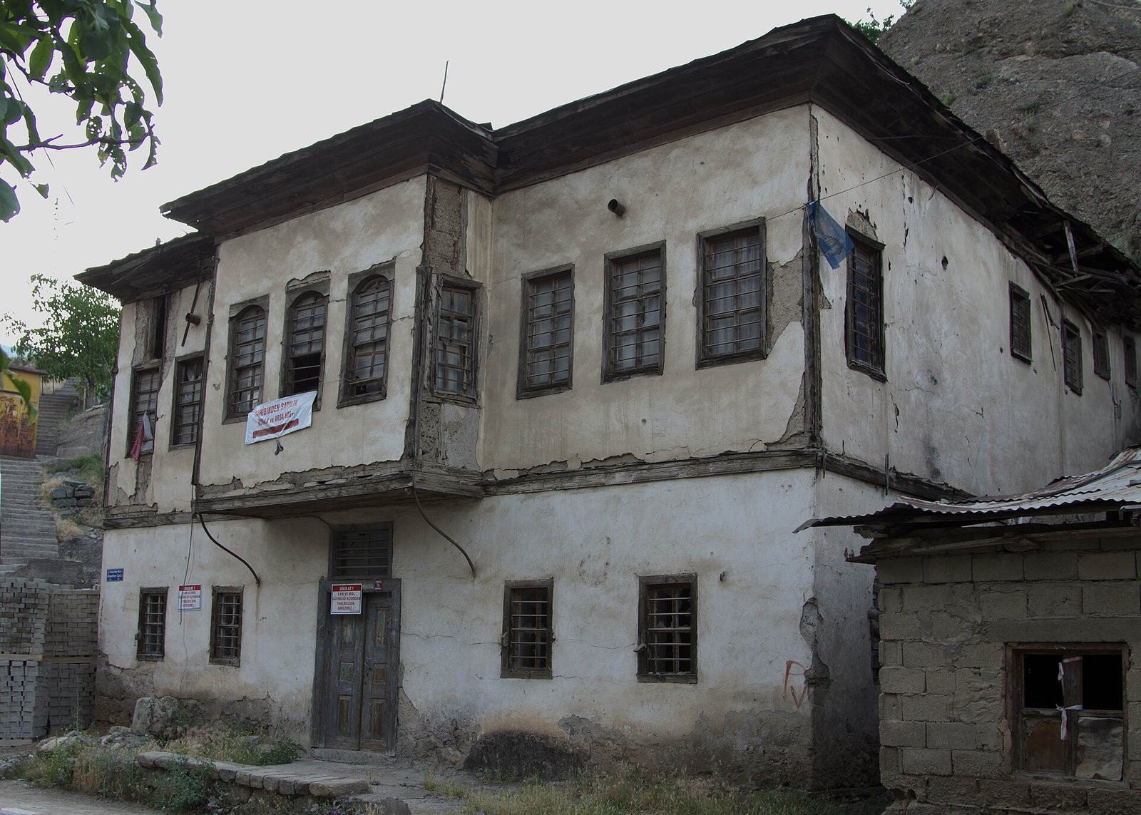
The governorate’s mansion inventory lists 59 registered mansions. Restored examples include Balyemez, Özdenoğlu, Hasan Fehmi Ataç and Zeki Kadirbeyoğlu. These houses form another substantial part of Gümüşhane’s surviving historical fabric, alongside Süleymaniye’s mosque and the region’s mining settlements.
In Yeşildere village, Greek craftsmen built a historic mansion in 1914. After the population exchange, the building served as a school for village children for approximately fifty years. Its history links domestic architecture with everyday education through a documented change of use.
Gümüşhane Museum occupies two neighbouring mansions dating from 1920. They were expropriated in 1998 and restored between 2004 and 2006. The museum has archaeology, coin and ethnography sections. Its garden displays stone objects brought from Satala and Süleymaniye, bringing material from different historical places into one setting.
FAQ
What does Gümüşhane mean?
Gümüşhane combines the Turkish word gümüş, meaning silver, with the Persian word hane, meaning house. The name relates to nearby silver mines.
When did Gümüşhane come under Ottoman rule?
The sources give different dates. Kültür Portalı connects the transition with 1461, while Abdürrahim Pamuk’s Belleten study dates its incorporation under Rakkas Sinan Bey to 1479.
Where is Old Gümüşhane?
Old Gümüşhane is Süleymaniye Mahallesi, approximately four kilometres southwest of the present city centre.
Was Gümüşhane called Argyropolis in Byzantine times?
The provincial culture directorate places the name Argyropolis in the Byzantine period. English Wikipedia instead dates its adoption to the early nineteenth century and says Greek-speaking residents also used Gümüşhane.
Sources
- Vikipedi — Gümüşhane tr.wikipedia.org
- Belleten — XVII. Yüzyılın Ortalarında Gümüşhane (Torul) Kazası belleten.gov.tr
- Kültür Portalı — Süleymaniye Mahallesi / Eski Gümüşhane kulturportali.gov.tr
- Gümüşhane İl Kültür ve Turizm Müdürlüğü — Tarihçesi gumushane.ktb.gov.tr
- Wikipedia — Gümüşhane en.wikipedia.org
- Doğu Karadeniz Kültür Envanteri — Sultan Süleyman Han Camii karadeniz.gov.tr
- Doğu Karadeniz Kültür Envanteri — Canca Kalesi karadeniz.gov.tr
- Kültür Portalı — Sarıçiçek Köy Odaları kulturportali.gov.tr
- Kültür Portalı — Santa Harabeleri kulturportali.gov.tr
- GoTürkiye — Gör Gümüşhane goturkiye.com
- Gümüşhane Valiliği — Gümüşhane Konakları gumushane.gov.tr
- Anadolu Ajansı — Atıl kalan tarihi konak turizmle yeniden canlandı aa.com.tr
- Kültür ve Turizm Bakanlığı — Gümüşhane Müzesi muze.gov.tr
Image: Gümüşhane Ottoman houses (Photo by Scott Dexter, June 20, 2012) (7884335224).jpg — Scott Dexter, CC BY-SA 2.0