What are the Historic Areas of Istanbul?
The Historic Areas of Istanbul are four protected zones inscribed on the UNESCO World Heritage List in 1985. They are Sultanahmet, Süleymaniye, Zeyrek and the Istanbul Land Walls. All four lie in Fatih, on the city’s European side. Together, they cover 765.5 hectares.
If you are searching for Istanbul’s historic district, start with this distinction: the UNESCO property has four components. Its protection extends across palaces, religious buildings, defenses and neighborhood fabric. Hagia Sophia and Topkapı Palace belong to the same inscription as Zeyrek’s wooden architecture and the areas beside the Land Walls.
The four zones bring Byzantine and Ottoman buildings into a shared geographical frame. The surviving Hagia Sophia dates to 532–537. Süleymaniye Mosque and its complex were built in 1550–1557. Between those dates sit the Pantokrator monastery churches and Topkapı Palace, each central to a different component.
Why are the Historic Areas of Istanbul on the UNESCO list?
UNESCO records the Historic Areas of Istanbul under cultural criteria (i), (ii), (iii) and (iv). The inscription dates to 1985, while a minor boundary modification received approval in 2017. The property’s recorded total area is 765.5 hectares.
The component descriptions show how widely the protection reaches. Süleymaniye includes its mosque complex, surrounding markets and traditional housing. The Land Walls component includes areas on both sides of the Theodosian walls and the remains of the former Blakhernai Palace. You are looking at protected settings as well as individual structures.
Historic Areas of Istanbul map: where are the four zones?
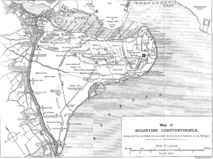
Place the Historic Peninsula on your map first. The Golden Horn borders it to the north. The Bosphorus lies to the east, and the Sea of Marmara to the south. The Land Walls mark its western boundary. All four UNESCO components sit within Fatih on this peninsula.
The components differ sharply in size. Sultanahmet covers 140 hectares. Süleymaniye covers 54 hectares, and Zeyrek 10.5 hectares. The Land Walls component covers 561 hectares, making it the largest. Zeyrek is the smallest, although its protected area includes both the mosque and its surrounding neighborhood.
These figures help you read the UNESCO map. A component named for a mosque can include housing and markets. A component named for walls can extend across adjoining land. The 561-hectare Land Walls designation, for example, includes territory on both sides of the defenses.
Which historic sites are in the Sultanahmet zone?
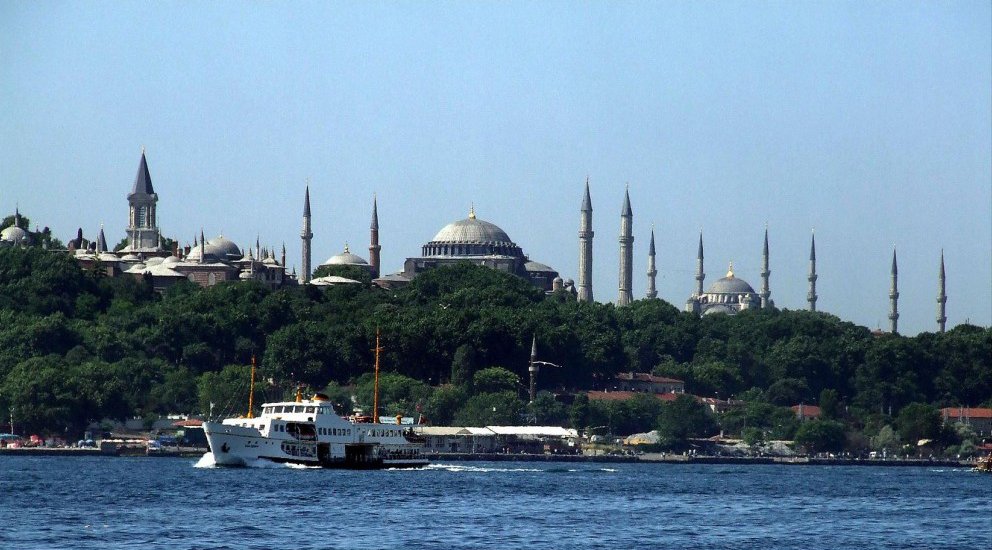
The Sultanahmet Urban Archaeological Area includes the Hippodrome, Hagia Sophia, Hagia Irene, Little Hagia Sophia and Topkapı Palace. Its 140 hectares bring these sites into one UNESCO component. For a reader beginning with familiar monument names, this is the zone containing both Hagia Sophia and Topkapı.
The Hagia Sophia building standing today was constructed between 532 and 537. That date belongs to the surviving structure. Within the same protected component, Topkapı Palace represents a later building campaign. Mehmed II commissioned it after the conquest of Istanbul, and construction ran from 1460 to 1478.
Sultanahmet also holds evidence at floor level. Excavations beginning in 1935 uncovered mosaics from the Great Palace’s colonnaded courtyard. Their scenes include a griffin eating a lizard and bears eating apples. These images add animals and recognizable actions to an area often approached through its monumental buildings.
What does the Süleymaniye Conservation Area protect?
Süleymaniye Mosque and its complex form the focus of this 54-hectare component. Mimar Sinan built them between 1550 and 1557. The construction dates place the complex after Mehmed II’s Topkapı Palace, whose building campaign ended in 1478.
UNESCO’s description includes surrounding markets and traditional residential fabric alongside the mosque complex. That scope gives you a direct link to everyday life: shopping and housing belong within the protected historical setting. The area’s significance can therefore be read through homes and commercial surroundings as well as the mosque.
Süleymaniye also helps explain the term “historic neighborhoods” in Istanbul. Here, the designated component connects a named architectural complex with the urban fabric around it. Its 54 hectares protect a broader setting than the mosque building alone.
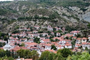
What makes Zeyrek a historic neighborhood?
The Zeyrek component covers 10.5 hectares around Zeyrek Mosque. Columbia University’s documentation describes the surrounding historic neighborhood as known for its wooden architecture. Although it is the smallest UNESCO component, it joins a major religious structure to a residential setting.
Zeyrek Mosque originated in the churches of the Pantokrator Monastery. Columbia dates those churches to 1118–1136. The group consists of three church units placed side by side. That arrangement is a concrete feature to keep in mind when you consider the building’s monastic origins.
The monastery’s foundation also carries an attribution question. An interpretation based on its typikon associates the foundation with John II Komnenos and probably his wife, Eirene. Some historical sources attribute patronage to Empress Eirene alone. The accounts therefore differ over how responsibility for the foundation should be assigned.
The typikon is the monastery’s foundation and operating document, dated 1136. It records a community of 80 male monks. Columbia’s account also identifies a hospital with 50 beds within the monastery. Those details connect the surviving churches with the organization of the institution around them.
Historic Areas of Istanbul walls: what is protected?
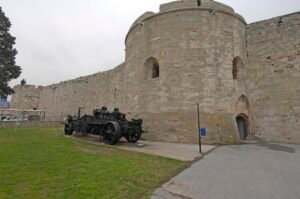
Construction of the Land Walls began in the early fifth century under Theodosius II. They stand along the Historic Peninsula’s western boundary. A 2019 Anadolu Agency report published by the Directorate of Communications gives their length as 6,600 meters.
The defensive arrangement has three parts: a moat, an outer wall and an inner wall. When you read about the walls, keep those separate elements in view. The documented defense consisted of successive parts, each belonging to the overall arrangement.
At 561 hectares, the Land Walls component occupies the greatest area of the four zones. UNESCO includes land on both sides of the Theodosian walls, together with the remains of the former Blakhernai Palace. Its boundaries consequently protect more than the standing defensive structures.
Timeline
- Early fifth century: Construction of the Land Walls began under Theodosius II.
- 532–537: The surviving Hagia Sophia building was constructed.
- 1118–1136: The Pantokrator Monastery churches, later associated with Zeyrek Mosque, were built.
- 1136: The Pantokrator typikon set out the monastery’s foundation and operation.
- 1460–1478: Mehmed II’s Topkapı Palace was built.
- 1550–1557: Mimar Sinan built Süleymaniye Mosque and its complex.
- 1935: Excavations began that uncovered the Great Palace courtyard mosaics.
- 1985: The four historic areas entered the UNESCO World Heritage List.
- 2017: UNESCO approved a minor boundary modification.
Details you won’t find in guidebooks
Topkapı Palace was long called the New Palace. The name distinguished it from the earlier palace in Beyazıt. This naming detail places the palace within a sequence of Ottoman palace buildings, alongside its documented construction dates of 1460–1478.
The Great Palace mosaics contain 90 different themes and 150 human and animal figures. The griffin eating a lizard and the apple-eating bears belong to this larger collection of scenes. Excavations beginning in 1935 brought the colonnaded courtyard’s floor mosaics to light.
At the Pantokrator Monastery, the 50-bed hospital and the 80 monks recorded in the typikon reveal two aspects of institutional life. The three adjoining church units survive as the architectural focus. The documentary details add the people and care facilities associated with the monastery.
FAQ
What are the four UNESCO zones of Istanbul?
They are the Sultanahmet Urban Archaeological Area, Süleymaniye Conservation Area, Zeyrek Conservation Area and Istanbul Land Walls Conservation Area.
Where are the Historic Areas of Istanbul?
All four components are in Fatih, on Istanbul’s European side. They lie on the Historic Peninsula, bordered by the Golden Horn, the Bosphorus and the Sea of Marmara.
When did the Historic Areas of Istanbul become a UNESCO site?
The four areas entered the World Heritage List in 1985. UNESCO approved a minor boundary modification in 2017.
Which UNESCO zone is the largest?
The Istanbul Land Walls component is the largest at 561 hectares. Zeyrek is the smallest at 10.5 hectares.
Sources
- UNESCO World Heritage Centre — Historic Areas of Istanbul whc.unesco.org
- UNESCO World Heritage Centre — Historic Areas of Istanbul: Maps whc.unesco.org
- Directorate General of Cultural Heritage and Museums — İstanbul’un Tarihi Alanları kvmgm.ktb.gov.tr
- Wikipedia — Historic Areas of Istanbul en.wikipedia.org
- Culture Portal — İstanbul’un Tarihi Alanları kulturportali.gov.tr
- National Palaces — Topkapı Palace millisaraylar.gov.tr
- Columbia University — Zeyrek Kilise Camii / Pantokrator Monastery mcid.mcah.columbia.edu
- Directorate of Communications / Anadolu Agency — İstanbul’un tarihi surları zamana direniyor iletisim.gov.tr
- Ministry of Culture and Tourism — Great Palace Mosaics Museum muze.gov.tr
Image: Topkapi Palace Hagia Sophia Blue Mosque.jpg — Salih K, Public domain