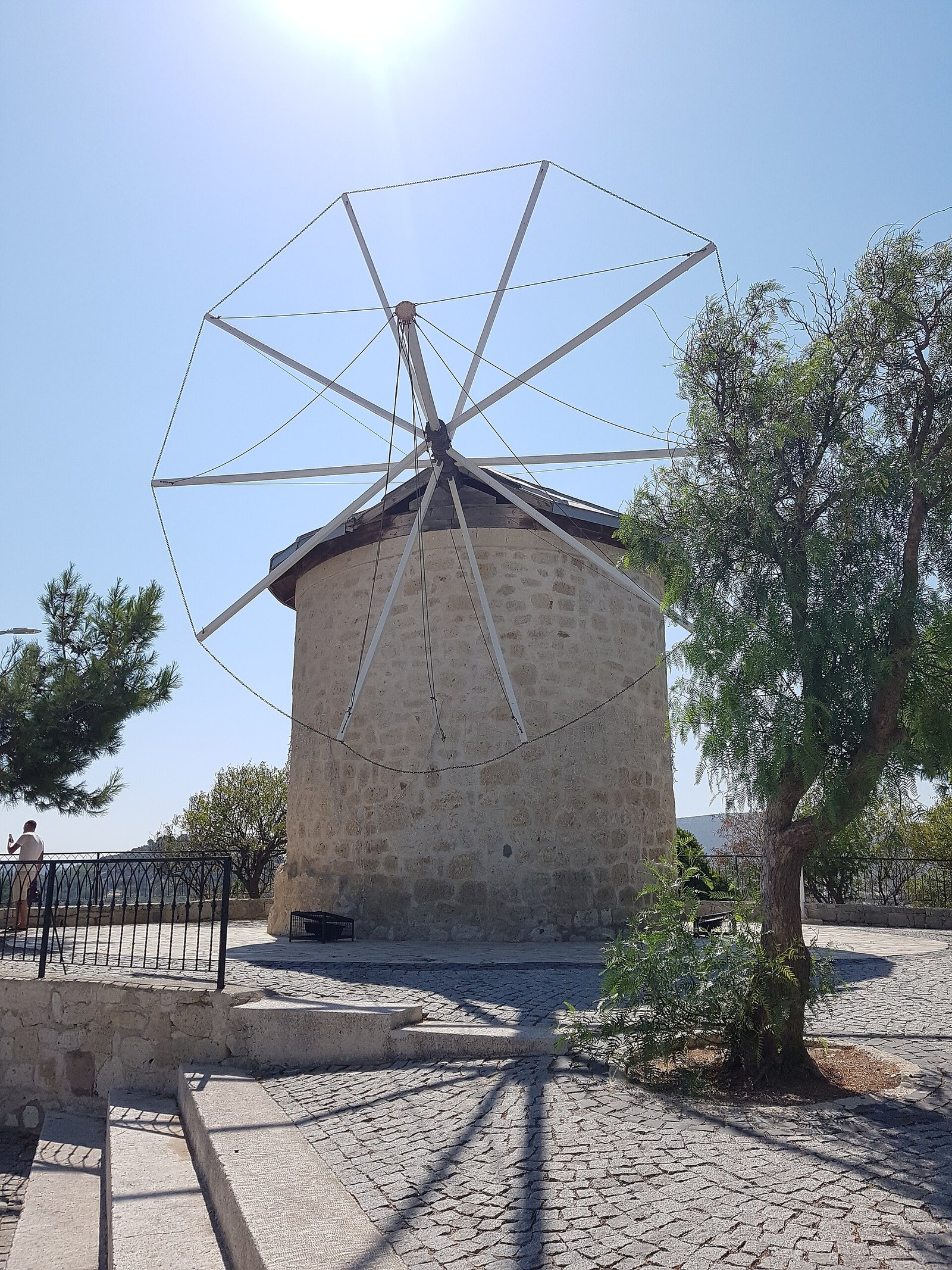
Alaçatı’s history is visible in local stone, adjoining houses and windmills above the settlement. Its streets also hold a former church that became a mosque. These buildings belong to a place shaped by migration and, later, tourism. Looking at them together connects architecture with the people and activities that changed the town.
The stone houses now accommodate several kinds of business, including hotels and cafés. Yet Alaçatı also carries the history of families who arrived after the Balkan Wars and the population exchange. If you come for its streets and wind, those movements of people give the buildings a wider historical setting.
Where is Alaçatı? Understanding “alaçatı nerede”
Alaçatı is a neighborhood in the Çeşme district of İzmir province, in Turkey’s Aegean Region. The D.300 Çeşme–İzmir state road lies to its north. To the south, it has a connection with the Çeşme–İzmir motorway. This location places the historic settlement within the wider Çeşme area.
Its administrative position has changed over time. In the arrangement established with the creation of Aydın Vilayeti in 1867, Alaçatı was a subdistrict center attached to Çeşme. The present neighborhood and the earlier administrative center represent different stages in the settlement’s history.
The name has a documentary history of its own. Records from 1525 use Alacat or Alacaat. In 1890, the recorded form was Alátsata. According to place-name records reported by Turkish Wikipedia, the settlement has borne its present name, Alaçatı, since 1928. These dates establish recorded forms of the name; they do not establish a founding date.
Stone houses: reading the streets through their buildings
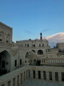
Alaçatı’s historic fabric includes adjoining, two-story houses built with local stone. Turkish and Greek architectural examples both appear within this fabric. The adjoining arrangement matters: the houses form connected stretches of street, giving the settlement a character that extends beyond any single façade.
Descriptions of the historic streets also identify one-story stone houses and cobbled paving. You can therefore read the streets at two scales. Individual buildings show their stone construction and height. The paving and neighboring houses show how those buildings belong to a larger setting.
Some old stone houses have become hotels, boutiques, bars and cafés as tourism has developed. Their present use is part of the story you encounter today. A building may retain its place in the historic streetscape while serving a different purpose from the house it once was.
Alaçatı çarşı: how commerce and housing shape the center
Within the urban conservation area, Kemalpaşa Caddesi runs east–west and is identified as the axis where commerce concentrates. Mithatpaşa Caddesi runs north–south and has a stronger residential character. The distinction offers a practical way to understand the center through the activities associated with its streets.
For readers searching for Alaçatı çarşı, this street pattern adds historical substance to the idea of a shopping district. Commerce is concentrated along a named axis within the protected urban fabric. Housing has its own principal axis. Both belong to the same settlement of stone buildings, narrow streets and small squares.
A former church within Alaçatı’s religious history
Hacı Memiş Mosque and Pazaryeri Mosque are monumental buildings within Alaçatı’s historic fabric. Pazaryeri Mosque began as Ayios Konstantinos Church. Yuhannis Halapes built the church in 1874, and the building later came into use as a mosque.
The former church has a basilican plan with three aisles. It was constructed using rubble-stone masonry. These features describe the building’s original architectural arrangement and construction. Its later religious use adds another stage to the history of the same structure.
The preserved iconostasis and the mihrab added on the southern side make that change especially tangible. The iconostasis survives from the church, while the mihrab belongs to its use as a mosque. Together, these elements allow you to connect the building’s religious history with specific parts of its interior.
Windmills and weather: the history behind “alaçatı hava durumu”
The historic stone windmills stand on a hill above Alaçatı and date to the 1850s. They are among the settlement’s recognized symbols. Their position above the houses brings wind into the architectural story, alongside the local stone used throughout the historic streets.
Wind also shapes Alaçatı’s modern tourism. İzmir’s provincial culture and tourism authority identifies May through October as its windy surfing season. From the middle of June to the middle of September, the wind blows mainly from the north. These are seasonal characteristics rather than a forecast for a particular visit.
Alaçatı harbor combines shallow water with a surface that remains relatively calm despite strong wind. Those conditions helped the bay become a windsurfing center. The hilltop windmills and the surfing waters belong to different parts of Alaçatı’s story, with wind connecting the two.
Migration and the population exchange
After the Balkan Wars, Bosniaks from Kolaşin and Albanians from Kosovo settled in Alaçatı. Their arrival forms part of the settlement’s population history. The stone streets should therefore be understood alongside movements of people, rather than through architectural features alone.
Following the population exchange, migrants arrived from Kavala, Kesriye, Karaferye and Karacaova. These places of origin help explain Alaçatı’s identity as a population-exchange town. Migration is central to the historical setting of its houses and neighborhoods.
A 2018 study by Deniz Hekimoğlu and Ayşegül Altınörs Çırak describes Alaçatı as retaining that population-exchange-town identity until 2000. The authors connect the subsequent rise of tourism with gentrification. Their account brings the settlement’s social history into the discussion of architectural conservation.
Timeline
- 1525: Records name the settlement Alacat or Alacaat.
- 1850s: The historic stone windmills above the settlement date to this period.
- 1867: Alaçatı appears as a subdistrict center attached to Çeşme under the new Aydın Vilayeti arrangement.
- 1874: Yuhannis Halapes builds Ayios Konstantinos Church, later used as Pazaryeri Mosque.
- After the Balkan Wars: Bosniaks from Kolaşin and Albanians from Kosovo settle in Alaçatı.
- After the population exchange: Migrants arrive from Kavala, Kesriye, Karaferye and Karacaova.
- 1928: Place-name records begin using the present name, Alaçatı.
- 2000: The endpoint identified by the 2018 study for Alaçatı’s population-exchange-town identity, followed by gentrification associated with tourism’s rise.
- 2018: Research published in TÜBA-KED examines Alaçatı’s architectural and social conservation problems.
Details you won’t find in guidebooks
Wells are set within Alaçatı’s narrow streets and small squares. They provide an everyday-life link within the historic fabric: water infrastructure occupies the spaces between houses. When you look beyond the façades, these wells bring ordinary practical needs into the architectural picture.
There is also an archaeological conservation area around Diyarbakır Sokak in Yeni Mecidiye Mahallesi. It lies in the northeastern part of the urban conservation area and contains church remains. Alaçatı’s religious architectural heritage therefore includes both the standing former church at Pazaryeri Mosque and remains elsewhere in the settlement.
At Pazaryeri Mosque, pebble mosaic covers the floor of the western courtyard. This is a different detail from the building’s rubble-stone walls and three-aisled plan. Looking down at the courtyard surface adds another material feature to the history visible in the structure.
The surfing waters have a less obvious characteristic, too. The official tourism account states that the current moves in the same direction as the wind. It identifies this alignment as a feature that helps surfers, alongside the harbor’s shallow water and relatively calm surface.
Where to eat and stay: stone buildings in everyday use
For searches such as “alacati where to eat” and “alacati where to stay,” the historical connection is the reuse of old stone houses. Some now serve as cafés, bars and hotels. Accommodation and refreshments have become part of the changing function of the historic built environment.
The reuse of houses also raises conservation questions. Hekimoğlu and Altınörs Çırak’s 2018 study reports problems associated with changes of function and unauthorized repairs. The businesses occupying historic buildings are therefore part of a broader story about tourism, social change and the care of architectural fabric.
FAQ
Where is Alaçatı?
Alaçatı is a neighborhood in the Çeşme district of İzmir province, in Turkey’s Aegean Region.
How old are Alaçatı’s windmills?
The historic stone windmills on the hill above the settlement date to the 1850s.
Was Pazaryeri Mosque originally a church?
Yes. Yuhannis Halapes built Ayios Konstantinos Church in 1874. The building later became Pazaryeri Mosque.
Sources
- Çeşme Kaymakamlığı — İdari Durum cesme.gov.tr
- Turkish Wikipedia — Alaçatı tr.wikipedia.org
- Visit İzmir — Alaçatı Kentsel Sit Alanı visitizmir.org
- Visit İzmir — Ayios Konstantinos Kilisesi–Pazaryeri Camii visitizmir.org
- GoTürkiye — Gör: Alaçatı, Çeşme ve Urla goturkiye.com
- İzmir İl Kültür ve Turizm Müdürlüğü — Rüzgar Sörfü izmir.ktb.gov.tr
- Deniz Hekimoğlu and Ayşegül Altınörs Çırak, TÜBA-KED — Soylulaşan Geleneksel Dokularda Koruma: Alaçatı dergipark.org.tr
Image: Alaçatı değirmenler 03.jpg — Justinianus, CC BY-SA 4.0