Hakkâri history: a city with a regional name
Hakkâri’s history begins with a distinction between a city and a region. The city’s former name was Çölemerik. Hakkâri historically named a much larger mountain region south of Lake Van. That region extended beyond Turkey’s present borders. If you are exploring the history of Hakkâri and the origin of its name, this distinction is the clearest starting point.
The surviving evidence spans very different periods. Thirteen stone stelae found in the city offer a way into the second millennium BCE. Madrasas preserve the names of local rulers. Koçanis preserves a church associated with the Nestorian patriarchate. These remains belong to a history that includes local Kurdish government, Assyrian communities and Ottoman centralization.
Hakkâri historical region: where did it extend?
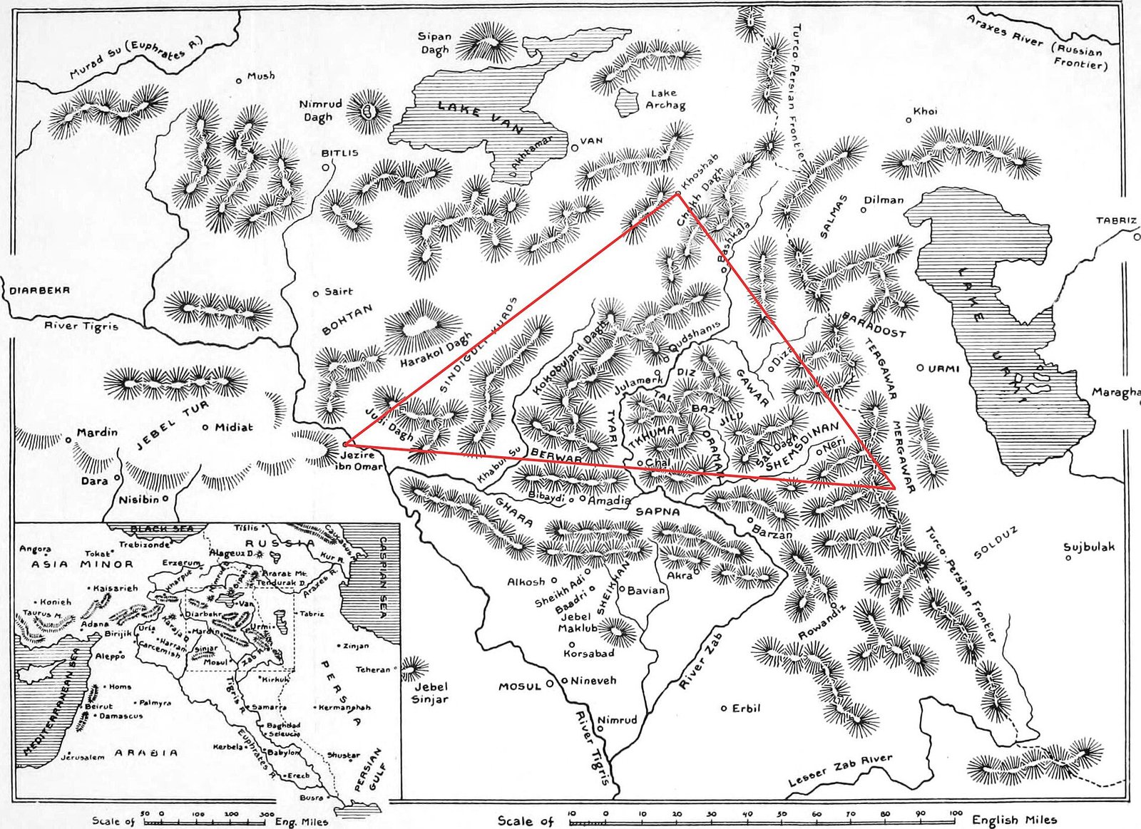
Historical Hakkâri reached toward Mosul in the south and Lake Van in the north. Its western extent approached Cizre. To the east, it reached the Lake Urmia area. These reference points describe a broader geography than the boundaries of today’s Hakkâri province.
When you encounter Hakkâri in a historical account, the name may therefore indicate the mountain region rather than the city. Çölemerik identifies the urban center more specifically. Keeping both names in view helps you distinguish the history of the settlement from events involving communities across the wider region.
What is the origin of the name Hakkâri?
One explanation connects Hakkâri with the Hakkar community. In this account, the name developed through the form Hakkariye. An alternative explanation links it to “her” and “karîn,” with a meaning associated with strength: “strong” or “those who are capable.” These remain competing explanations of the name.
The older city name has a separate proposed derivation. An explanation of Culemerg divides it into “cu,” meaning a water channel, “le,” a locative element, and “merg,” meaning meadow. Together, these are interpreted as “pasture through which water channels wind.” This theory concerns the settlement’s name, rather than the regional name Hakkâri.
The forms Çölemerik, Culemerg and Cûlâmerik appear in accounts of the city. Kâtib Çelebi used Cûlâmerik in the seventeenth century. He described a town attached to the Van province, with a castle on a hill between two valleys. His account connects a historical name with a specific urban landscape.
Stone stelae and archaeological evidence
In 1998, thirteen stone stelae were discovered accidentally in central Hakkâri. They were found at the foot of Çölemerik Castle. This group is a major source for studying the region’s second-millennium BCE past. The stones were subsequently placed on display at Van Museum.
Veli Sevin and Aynur Özfırat proposed dating the stelae between the middle and later parts of the second millennium BCE. Their argument rests on the weapon types shown on the stones. The date is therefore an archaeological proposal based on depicted objects.
The identity of those who commissioned the stones remains debated. One theory associates them with the Turukku. Another attributes them to princes of Hubishkia. Neither attribution should be treated as settled. The images and weapons provide evidence to examine, while the proposed identities remain interpretations.
Kurdish emirs, Assyrian communities and Ottoman rule
During the sixteenth century, Hakkâri continued under Ottoman rule as an emirate administered by local Kurdish beys. This arrangement placed local rulers within an Ottoman framework. Zeynel Bey’s construction of a madrasa in 1560 provides a named building project from this period.
The region’s Assyrian history also has a surviving architectural focus. At Koçanis, Mar Şalita Church served as the center of the Nestorian patriarchate. Its inscription gives the date 1689. The building connects the history of a religious institution with a particular village and a dated monument.
The nineteenth century brought massacres of Assyrian communities. Following the alliance between Bedirhan Bey and Hakkâri Emir Nurullah Bey, Hakkâri Assyrians suffered massacres in 1843. Tiyari Assyrians suffered massacres in 1846. These events are essential to understanding the region’s political and communal history.
Bedirhan Bey was defeated in 1847 and exiled to Crete. His defeat marked one of the turning points in the strengthening of Ottoman central control around Hakkâri. The sequence links the history of local rulers with the expansion of central authority.
Madrasas, a castle and stone houses
Meydan Madrasa stands in Biçer Mahallesi in central Hakkâri. Its entrance inscription records construction in 1700–1701 by İbrahim Bey, son of İzzeddin. The building has two floors, an internal courtyard and a flat roof. Built from cut stone, it measures 18.25 by 23.40 meters externally.
Zeynel Bey Madrasa was commissioned by Hakkâri ruler Zeynel Bey in 1560. Its remains were identified during surface surveys in 1998. Excavation and clearance followed in 2005. The exposed sections included a courtyard, an iwan, eight rooms and Zeynel Bey’s grave.
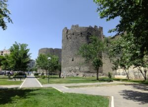
Çölemerik Castle occupies a commanding hill in Dağgöl Mahallesi. Its site covers 3,706 square meters. Archaeological work began there in 2024 under Van Museum Directorate. The team comprised sixteen people, including four archaeologists. The castle is also the landmark beside which the stelae were discovered.
Beyond the city center, Çukurca’s historical houses show another form of stone construction. They were built on the slope of Çukurca Castle, using cut stone. The houses have multiple floors and lean against the castle. Their arrangement makes the relationship between housing and the castle directly visible.
In Şemdinli, Nehri Stone Bridge stands four kilometers from Bağlar village. It has a single arch and measures twenty-one meters long and eleven meters high. Alongside the madrasas, church and houses, it adds a different kind of structure to Hakkâri’s surviving built heritage.
Details you won’t find in guidebooks
The discovery of the stelae began with an everyday household task. In 1998, Necdet Yılmaz was collecting earth from the castle’s foot to repair his house’s earthen roof. He uncovered the stones during that work. If you picture a roof repair, you can connect this archaeological discovery with an ordinary need at home.
The stelae range from 0.70 to 3.10 meters in height. Human figures were worked onto only one face of each stone. Their imagery extends beyond warriors. It includes steppe-style tents, leopard hunting and leopards attacking wild goats.
Meydan Madrasa’s courtyard arcades use different supports on the two floors. Cylindrical columns carry the lower arcade. Piers support the upper one. You can use this small architectural distinction to read the courtyard’s structure, alongside its two-story arrangement and flat roof.
The façade of Koçanis Church in Konak village carries an eight-line Assyrian inscription. It also has two circular sundials. These details complement the church’s association with the Nestorian patriarchate and its dated inscription of 1689.
Hakkâri in the Republic and the mountain landscape
Hakkâri became the center of the re-established province under Law No. 2885, dated 4 January 1936. The city’s recorded population was 1,562 in the 1935 census and 1,821 in 1940. These figures provide a concrete measure of the settlement around that administrative change.
The wider mountain landscape also contains historical traces. In Geverok Valley, within the Cilo and Sat mountains, rock surfaces bear human figures, animal forms and symbols. These carvings add another body of visual evidence to consider alongside the city’s stone stelae.
Hakkâri Cilo and Sat Mountains National Park was declared in 2020. It covers 27,500 hectares and consists of two sections: the Cilo Glaciers and Sat Lakes. That modern designation belongs to the same mountain landscape in which Geverok’s rock images survive.
Timeline
- Middle to late second millennium BCE: Proposed date of the Hakkâri stelae, based on depicted weapon types.
- Sixteenth century: Local Kurdish beys administer Hakkâri under Ottoman rule.
- 1560: Zeynel Bey commissions his madrasa.
- 1689: Date recorded in the inscription of Koçanis Mar Şalita Church.
- 1700–1701: İbrahim Bey, son of İzzeddin, commissions Meydan Madrasa.
- 1843 and 1846: Massacres target Hakkâri and Tiyari Assyrians.
- 1847: Bedirhan Bey is defeated and exiled to Crete.
- 1936: Hakkâri province is re-established.
- 1998: Thirteen stone stelae are discovered in the city.
- 2005: Excavation and clearance expose sections of Zeynel Bey Madrasa.
- 2020: Cilo and Sat Mountains National Park is declared.
- 2024: Archaeological work begins at Çölemerik Castle under Van Museum Directorate.
FAQ
What was Hakkâri previously called?
The city was previously called Çölemerik. Hakkâri historically referred to a larger mountain region extending south from Lake Van and beyond Turkey’s present borders.
What does the name Hakkâri mean?
One theory connects it to Hakkariye, derived from the Hakkar community. Another links “her” and “karîn” to the meaning “strong” or “those who are capable.” These are alternative explanations.
Where was the historical Hakkâri region?
It extended toward Mosul in the south, Lake Van in the north, Cizre in the west and the Lake Urmia area in the east. It was larger than the present province.
Why are the Hakkâri stelae important?
The 13 stone stelae discovered in 1998 are a major archaeological group for studying the region during the second millennium BCE. Their proposed dating rests on the weapons depicted on them.
Sources
- TDV İslâm Ansiklopedisi — Hakkâri islamansiklopedisi.org.tr
- Hakkâri Provincial Directorate of Culture and Tourism — Tarihte Hakkari hakkari.ktb.gov.tr
- Türkiye Culture Portal — Hakkari kulturportali.gov.tr
- Belleten — Hakkari Stelleri: Doğu Anadolu’da Savaşçı Çobanlar İlk Not belleten.gov.tr
- Archaeology — Veli Sevin, Mystery Stelae archive.archaeology.org
- TÜBA-AR — Hakkari Stelleri: Zap Irmağı Kıyısında Bozkır Göçebeleri dergipark.org.tr
- Hakkâri Provincial Directorate of Culture and Tourism — Hakkari Stelleri hakkari.ktb.gov.tr
- Hakkâri Provincial Directorate of Culture and Tourism — Kültürel Hazineler hakkari.ktb.gov.tr
- Wikipedia — Hakkâri Province en.wikipedia.org
- Wikipedia — Hakkari (historical region) en.wikipedia.org
- Türkiye Culture Portal — Meydan Medresesi kulturportali.gov.tr
- Directorate of Communications — 464 yıllık tarihî medrese, yeniden ayağa kaldırılıyor iletisim.gov.tr
- Anadolu Agency — Çölemerik Kalesi’nin sırrı kazı çalışmasıyla çözülecek aa.com.tr
- Türkiye Culture Portal — Çukurca Tarihi Taş Evler kulturportali.gov.tr
- Türkiye Culture Portal — Nehri Taş Köprü kulturportali.gov.tr
- Milel ve Nihal — Yaşar Kaplan, Hakkâri’de Nestûrî Patrikliğinin Son Dönemi (1876–1915) dergipark.org.tr
- Ministry of National Education — Konak (Koçanis) Kilisesi okuldisiogrenme.eba.gov.tr
Image: Hakkari Map.jpg — Wigram, Edgar Thomas Ainger, Sir, 1864-1935, Public domain