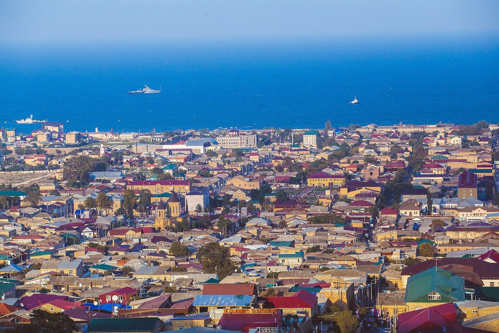
Derbent is a historic city in Russia’s Republic of Dagestan, on the western shore of the Caspian Sea. It stands where the Caucasus Mountains approach the coast, leaving a narrow passage. Its hilltop citadel, Naryn-Kala, and long defensive walls belong to a system built to control that corridor.
If you want to understand Derbent, start with its setting. The coastal strip is only about three kilometres wide. Within that restricted space, the city’s defences linked the shore to the citadel and continued west into the mountains. Geography explains why walls became such a defining part of the city.
Where is Derbent in Russia and Dagestan?
Derbent lies at approximately 42.0578° north and 48.2889° east. It belongs to the Republic of Dagestan within the Russian Federation. Dagestan’s capital is Makhachkala; Derbent is the historic city associated with the coastal passage and its fortifications.
For readers planning travel around Turkey, the location is an essential distinction: this Derbent is in Dagestan, Russia. Its historical setting is the western Caspian coast. When you locate the sea and the Caucasus Mountains together, the relationship between the city and its defensive walls becomes easier to follow.
What is the Derbent Pass?
The Derbent Pass is a natural corridor connecting the Eurasian steppes to the north with the Iranian plateau to the south. The approximately three-kilometre coastal strip gave this north–south route a confined setting. Derbent’s defensive system occupied that passage between mountain and sea.
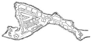
The walls extended across more than the inhabited city. Two parallel lines ran between the sea and Naryn-Kala, while a mountain wall continued west from the citadel. Together, these elements show the geographical reach of the defences. The hilltop fortress was one part of a much longer system.
What does Derbent mean? “Derbent ne demek” and “Derbent nedir”
The name Derbent derives from the Persian form Darband. Its components are dar, meaning “gate,” and band, meaning “barrier” or “embankment.” These words fit a city whose fortifications controlled a narrow passage beside the Caspian Sea.
Another historical name expresses the same association with gates. Hudud al-Alam, as cited by Turkish Wikipedia, calls Derbent Bab al-Abwab, meaning “Gate of Gates.” For readers asking “Derbent nedir,” the historical subject is therefore both a city and a fortified gateway through the coastal corridor.
How old is Derbent?
Derbent’s age requires several dates. UNESCO places the earliest physical evidence of a defensive function in the eighth and seventh centuries BCE. That evidence concerns the use of the location for defence. It should be distinguished from the chronology of continuous urban settlement and the surviving stone fortifications.
Excavations conducted from the late 1970s onward confirmed approximately 2,000 years of continuous urban settlement, according to UNESCO. This gives the city a long archaeological history without assigning every surviving structure the same age. Early defensive activity, urban occupation, and wall construction belong to different questions.
The Sasanian defensive system adds another chronological layer. UNESCO places its beginnings in the fifth century. An inscription study in Encyclopaedia Iranica argues for the completion of the northern stone wall and citadel in 568–569. These dates concern particular phases and structures within Derbent’s longer history.
How did the Derbent wall work?
Derbent had two parallel city walls, separated by approximately 300–400 metres. They extended about 3.6 kilometres from the sea to the citadel. Their arrangement connected the coastal end of the defences with the fortified position on the hill.
The mountain wall continued approximately 40 kilometres west from Naryn-Kala. This extension is essential to understanding the scale of the system. If you picture only the citadel, you miss the long defensive line that continued beyond it into the mountains.
The coastal end also reached beyond the shoreline. UNESCO states that walls protecting the harbour extended 500 metres into the Caspian Sea. Derbent’s fortifications therefore included a seaward component as well as city walls, a hilltop citadel, and a mountain wall.
What is Naryn-Kala, Derbent’s fortress or castle?
Naryn-Kala is the hilltop citadel of Derbent’s defensive system. Readers searching for “Derbent fortress” or “Derbent castle” are looking for this major fortified element. The parallel city walls extended between the citadel and the sea, placing it within the larger defensive arrangement.
The citadel’s stone walls measure approximately 2.5–3.2 metres thick and 10–15 metres high. These dimensions give a concrete sense of the structure’s scale. Its position above the city and its connection to the walls explain its role within the coastal defences.
In 2003, UNESCO inscribed Derbent’s citadel, ancient city, and fortress buildings on the World Heritage List. Naryn-Kala belongs to a historic ensemble that also contains the old city and its defensive structures.
When were the Sasanian fortifications built?
Encyclopaedia Iranica connects the major fortification work of the late 560s with Sasanian Iran’s defence against the threat of the Turkic Khaganate. Its inscription analysis supports 568–569 for the northern stone wall and citadel. That interpretation places their completion in the thirty-seventh regnal year of Khosrow I.
The reading is debated. A published alternative assigns the regnal date to Kavad I. UNESCO, meanwhile, places the beginning of the defensive system in the fifth century. The broader beginning of the fortifications and the proposed completion date for specific stone structures should therefore remain distinct.
How did Derbent’s political history change?
Turkish Wikipedia dates the Arab capture of Derbent to 654. It describes the city’s subsequent role as an administrative centre through which Islam spread into the region. The fortified passage thus also formed part of the city’s administrative and religious history.
Derbent became the capital of the khanate of the same name, established in 1747. In 1813, the Treaty of Gulistan transferred Qajar Iran’s sovereignty over Derbent and Dagestan to the Russian Empire. These changes help explain how a city with Sasanian fortifications came to stand within present-day Russia.
Details you won’t find in guidebooks
One small inscription brings Derbent’s walls close to everyday life. Middle Persian inscription number 23 on the northern wall contains only the word “water.” It stands beside early medieval ceramic water pipes. If you think about the water you use each day, this brief text offers a direct connection with the practical needs represented in the archaeological remains.
Other Sasanian inscriptions on Naryn-Kala’s walls preserve the names Mōšīg and Ādurgušnasp, who were responsible for construction. These names add people to the chronology of stonework. The fortifications carry evidence of named individuals involved in their building, alongside the debated royal dating.
Excavations in 2017 investigated a nine-room building complex at the Derbent settlement. Bronze belt buckles, a fibula, and Sasanian pottery supported its dating to the fifth century. The complex supplies evidence for buildings within the settlement alongside the larger history of defensive construction.
The harbour walls provide another easily overlooked detail: they extended 500 metres into the Caspian Sea. Set beside the approximately 40-kilometre mountain wall, this measurement shows how far the defensive scheme reached on either side of the citadel.
What was Naryn-Kala’s underground structure?
A cross-shaped underground structure inside Naryn-Kala measures approximately 11 metres high. Its north–south dimension is 14.8 metres, while its east–west dimension is 13.4 metres. Its shape and scale have prompted different interpretations of its original purpose.
Proposals include a Christian church of the fifth or sixth century and a Zoroastrian fire temple. A study published in 2019 states that the structure served as a water reservoir in the seventeenth and eighteenth centuries. It does not establish the building’s first function. Its later use as a reservoir should therefore remain separate from theories about its origin.
In spring 2018, researchers examined the structure using cosmic-ray muons. Detectors placed at a depth of approximately 10 metres collected measurements for two months. This investigation brought a different method to the study of the underground building, while its original purpose remained unresolved.
What is Derbent’s weather like?
Derbent’s climate is classified as BSk, or cold semi-arid, under the Köppen system. The published climate table gives a daily mean temperature of 2.1°C in January and 24.9°C in July. These are monthly averages, giving a seasonal frame for readers interested in visiting the historic city.
Timeline
- Eighth–seventh centuries BCE: Earliest evidence of a defensive function identified by UNESCO.
- Fifth century: Early Sasanian fortification phase and settlement buildings identified through excavation.
- 568–569: Proposed completion of the northern stone wall and citadel under one inscription interpretation.
- 654: Arab capture of Derbent, as dated by Turkish Wikipedia.
- 1747: Derbent becomes the capital of its namesake khanate.
- 1813: Transfer to the Russian Empire under the Treaty of Gulistan.
- 2003: Citadel, ancient city, and fortress buildings enter the World Heritage List.
- 2017: Excavation investigates the nine-room building complex.
- 2018: Muon radiography experiment examines the cross-shaped underground structure.
FAQ
Where is Derbent?
Derbent is in Russia’s Republic of Dagestan, on the western shore of the Caspian Sea. It occupies a narrow coastal corridor between the sea and the Caucasus Mountains.
How old is Derbent?
UNESCO identifies evidence of a defensive function in the eighth and seventh centuries BCE. Excavations also support about 2,000 years of continuous urban settlement.
What is Naryn-Kala?
Naryn-Kala is the hilltop citadel of Derbent’s defensive system. Two parallel city walls connected the citadel with the Caspian shore.
What does Derbent mean?
The name derives from the Persian form Darband, combining dar, meaning gate, with band, meaning barrier or embankment.
Sources
- UNESCO — Citadel, Ancient City and Fortress Buildings of Derbent whc.unesco.org
- Encyclopaedia Iranica — Darband Epigraphy I iranicaonline.org
- Applied Sciences — Muon Radiography Method for Non-Invasive Probing an Archaeological Site in the Naryn-Kala Citadel mdpi.com
- History, Archeology and Ethnography of the Caucasus — Excavation of Derbent Settlement in 2017 caucasushistory.ru
- Wikipedia — Derbent en.wikipedia.org
- Vikipedi — Derbent, Dağıstan tr.wikipedia.org
- Vikipedi — Dağıstan tr.wikipedia.org
Image: Derbent. Dagestan.jpg — Аль-Гимравий, CC BY-SA 3.0