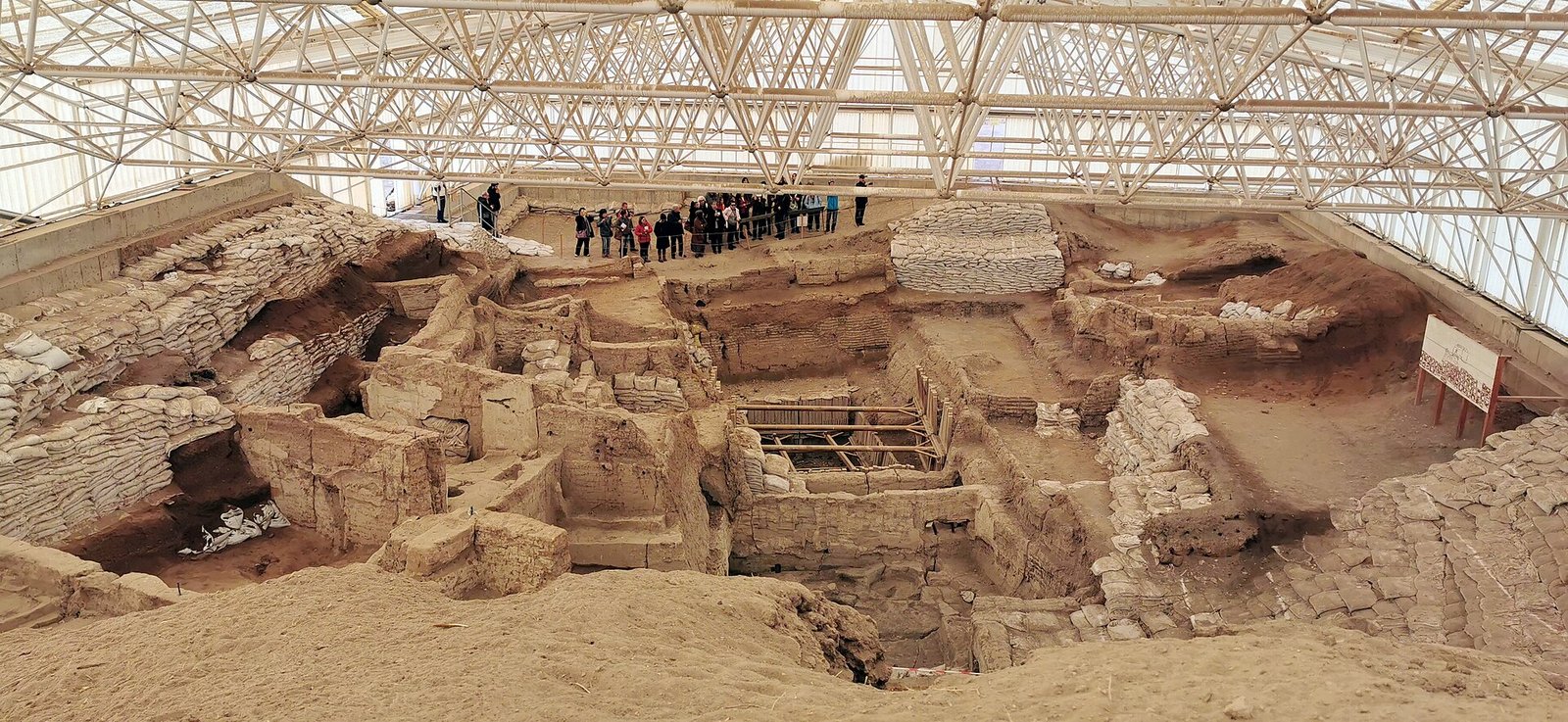
Where Is Çatalhöyük? Çatalhöyük in Konya, Türkiye
Çatalhöyük is a prehistoric settlement in the Çumra district of Konya Province, near Küçükköy. It lies southeast of today’s Konya city, on the Konya Plain.
The excavation project’s visiting page puts it about 60 kilometres from Konya. If you drive, you follow the Konya–Karaman road toward Çumra.
So the short answer to “Çatalhöyük Konya” is yes. The site is in the province of Konya, but not in the city centre. Plan a day trip.
What Does Çatalhöyük Mean?
The name joins two Turkish words. One is çatal. The other is höyük, a mound formed when the remains of a settlement pile up over time.
That second word describes the place well. Today’s mound is the result of people filling in old houses and building new ones on top. They repeated this again and again through the life of the settlement.
Was This the World’s First City?
This is the question most people type into Google. The honest answer is: it depends on what you call a city.
English Wikipedia classes Çatalhöyük as a large “proto-city” of the Neolithic and Chalcolithic periods. UNESCO describes it as evidence of the shift from villages to urban settlement. That wording does not make it the undisputed first city.
There is a second problem. Archaeologists once thought Çatalhöyük was the first settled community. The excavation project’s guide says we now know settled life in the Middle East began several thousand years earlier.
So Çatalhöyük is not the first village, and “first city” is not proven. Its value lies elsewhere. It shows, in unusual detail, how a large early farming community lived and organised itself.
The population is also a rough figure. The project’s guide gives an estimate of about 3,500 to 8,000 people, not a count.
Why Is Çatalhöyük Important?
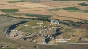
UNESCO lists two mounds at the site. The East Mound holds 18 Neolithic layers of settlement dated to 7400–6200 BCE. The West Mound holds Chalcolithic phases dated to 6200–5200 BCE.
That is a span of about 2,200 years. The World Heritage area covers 37 hectares and includes both mounds. UNESCO inscribed it in 2012 as site number 1405.
The importance is the long record. Layer after layer, you can follow one community through many generations.
Houses Without Streets
The houses of Çatalhöyük were mud-brick buildings. They were rectangular and packed close together. There were no streets between them.
How did people get around? Over the roofs. They went down into each house on wooden ladders.
Imagine your own front door is a hatch in the ceiling. Every trip to the neighbours means a walk across the rooftops. That was daily life here.
Inside the main rooms, the project’s architecture page records an oven beneath the ladder. It also records raised platforms and storage rooms opening off the main room.
The walls and floors were plastered white. They were decorated with hunting scenes and geometric patterns.
Wall Paintings
The wall paintings are among the best-known features of the site. The plastered surfaces carry hunting scenes and geometric designs.
One famous reading says a painting shows the settlement plan next to an erupting Hasan Dağı. If true, it would be an early map.
Not everyone agrees. In a 2006 article, Stephanie Meece found a different reading more plausible. She saw a leopard skin in the geometric patterns. The map idea is a theory, not a fact.
Religion and Burial
The dead were buried beneath the house floors. The bodies were often bent and tightly bound.
In this settlement, death was part of the house.
For years, female figurines fed the idea of a mother goddess cult. The excavation project questions this. It stresses that male and animal figurines are also common.
So “mother goddess religion” is one interpretation. It is not a proven description of what people believed.
Civilization and Daily Life
The people of Çatalhöyük ate plants such as barley and wheat. They also ate fish and beef.
They used obsidian, a volcanic glass for tools. Some of it came from Cappadocia and Eastern Anatolia. Material for daily life travelled across long distances.
A 2025 study in Science analysed 131 paleogenomes. It found that genetic ties between people buried in the same buildings ran mostly through maternal lines.
The study also showed a change over time. In the early periods, people buried in the same building were often close relatives. In later periods, those buried in one building were often not genetically related.
Does this prove a matriarchal society? Researcher Merve Nur Güler is not sure the term fits on this data alone. The findings show female-centred practices, but the label “matriarchy” goes further than the evidence.
Photos and Reconstructions
For a picture of what the town looked like when it was alive, look at reconstructions.
The excavation project’s architecture page has three useful ones:
- John Swogger’s illustration of the settlement, showing movement across the roofs.
- Kathryn Killackey’s drawing of a house.
- Grant Cox’s three-dimensional model of an entrance.
These are interpretations by specialists. They help you see how the rooftop town worked.
Timeline
- 7400–6200 BCE: Neolithic settlement phases of the East Mound, by UNESCO’s dating.
- 6200–5200 BCE: Chalcolithic settlement phases of the West Mound, by UNESCO’s dating.
- 1958: David French, Alan Hall and James Mellaart bring the site to the attention of archaeology. Local people already knew it.
- 1961: Mellaart leads the first excavation season.
- 1993: Ian Hodder restarts research after a long break.
- 2006: Stephanie Meece publishes her article against the map reading of the wall painting.
- 2012: Çatalhöyük is added to the UNESCO World Heritage List.
- 21 November 2023: The Çatalhöyük Introduction and Welcome Centre opens.
- 2025: The Science paleogenome study on maternal lines and changing kinship is published.
Details You Won’t Find in Guidebooks
Some walls were replastered up to 450 times. Findings show that some house interiors were re-plastered up to 450 times. Compare it with repainting your living room. Few people do it more than a handful of times in a lifetime.
Houses could be taken apart without touching the neighbours. Houses standing side by side had separate outer walls. That let people dismantle and rebuild one house without disturbing the buildings next to it.
The first dig was short. Mellaart’s first season in 1961 lasted 39 days. In that time, 40 houses were uncovered.
Obsidian came from far away. The obsidian used at the site came from sources including Cappadocia and Eastern Anatolia.
Family ties changed. Early on, people buried together were often close relatives. Later, they often were not related by blood.
Visiting Çatalhöyük
The Introduction and Welcome Centre opened on 21 November 2023. Its indoor exhibition space covers 4,500 square metres. It explains the surroundings of Çatalhöyük, the excavations, the houses, daily life and burial practices.
The finds are in two museums. Objects from Mellaart’s period are in the Museum of Anatolian Civilizations in Ankara. Objects from Hodder’s period are in the Konya Archaeological Museum.
If you want to see the objects as well as the mound, you may need to visit more than one place.
FAQ
Where is Çatalhöyük located?
It is in the Çumra district of Konya Province, near Küçükköy, on the Konya Plain. The excavation project places it about 60 kilometres from Konya city.
Was Çatalhöyük the world’s first city?
That is not settled. UNESCO describes it as evidence of the shift from villages to urban settlement, which is not the same as being the first city. English Wikipedia classes it as a large proto-city.
How many people lived in Çatalhöyük?
There is no exact count. The excavation project’s guide gives an estimate of roughly 3,500 to 8,000 people.
Are the wall paintings at Çatalhöyük a map?
One claim says a painting shows the settlement plan with an erupting Hasan Dağı. In a 2006 article Stephanie Meece found a leopard-skin reading of the geometric patterns more plausible.
Where are the finds from Çatalhöyük kept?
Finds from James Mellaart’s era are in the Museum of Anatolian Civilizations in Ankara. Finds from Ian Hodder’s era are in the Konya Archaeological Museum.
Sources
- Turkish Wikipedia — Çatalhöyük tr.wikipedia.org
- English Wikipedia — Çatalhöyük en.wikipedia.org
- UNESCO — Neolithic Site of Çatalhöyük whc.unesco.org
- Çatalhöyük Research Project — Site Guide Book catalhoyuk.com
- Çatalhöyük Research Project — Architecture catalhoyuk.com
- Çatalhöyük Research Project — Life at Çatalhöyük catalhoyuk.com
- Çatalhöyük Research Project — Excavation History catalhoyuk.com
- Çatalhöyük Research Project — Visiting Us catalhoyuk.com
- Stephanie Meece, A bird’s eye view (University of Cambridge repository) repository.cam.ac.uk
- Konya Metropolitan Municipality — Çatalhöyük Introduction and Welcome Centre konya.bel.tr
- Ministry of Culture and Tourism — Opening of the Çatalhöyük Introduction and Welcome Centre basin.ktb.gov.tr
- Hacettepe University — Female lineages and changing kinship patterns in Neolithic Çatalhöyük avesis.hacettepe.edu.tr
- METU News — Female-centered and Communal haber.metu.edu.tr
Image: Çatalhöyük, 7400 BC, Konya, Turkey – UNESCO World Heritage Site, 08.jpg — Murat Özsoy 1958, CC BY-SA 4.0