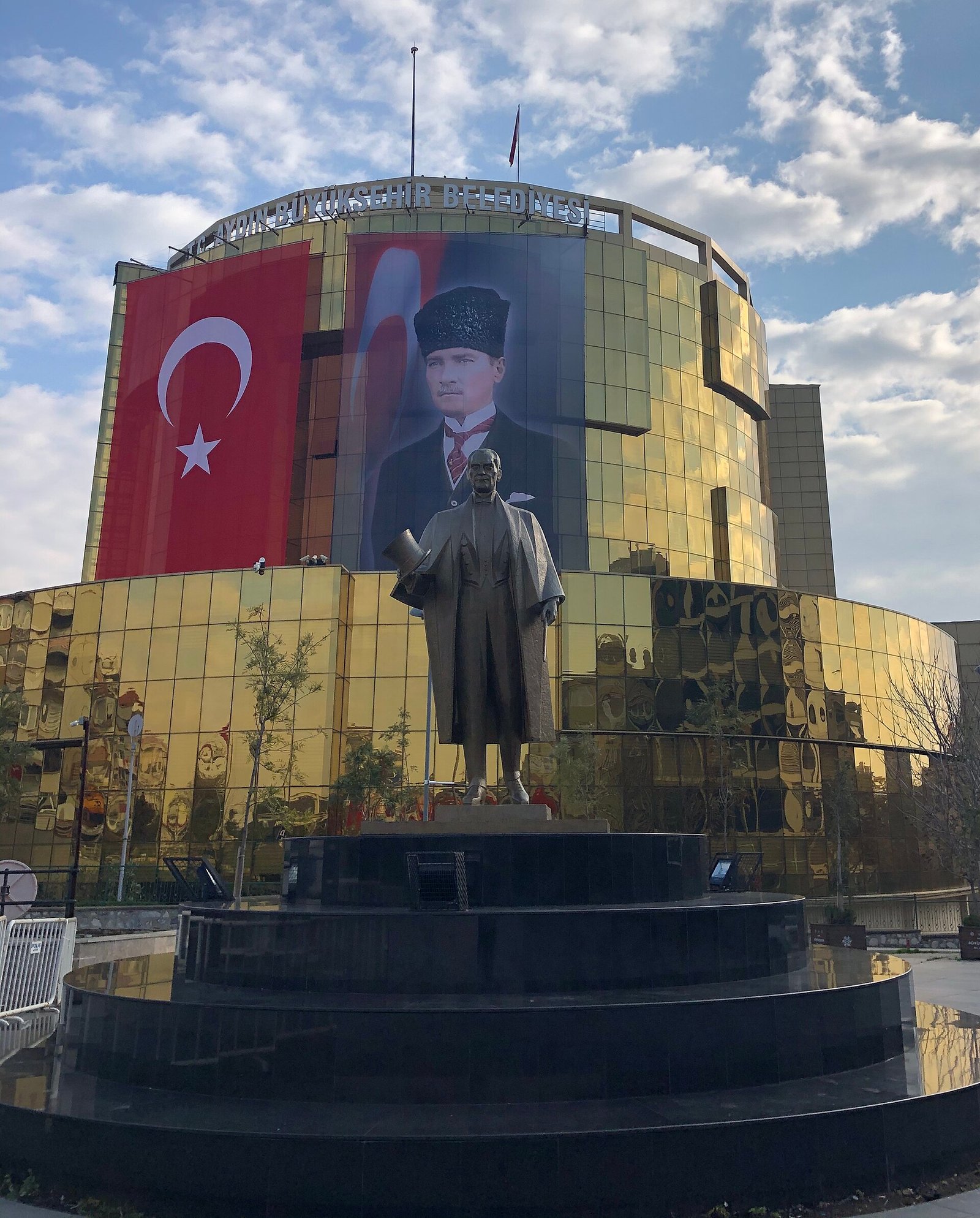
If you are searching for the history of Aydın, start with one fact. This city has carried several names, and each one marks a different era. Its ancient name was Tralleis. Its historical name under Turkish rule was Güzelhisar. Its modern name points to a dynasty of the 14th century.
This article follows those names. It also covers the ruins, mosques, railway and wartime dates that fill in the story.
Aydın history at a glance
Aydın’s urban history reaches back to Tralleis, the ancient city. Under Turkish rule the city was known as Güzelhisar. Over time that name gave way to Aydın.
The layers are easy to see on the ground. A Roman-era ruin stands just outside the centre. Ottoman buildings from the 18th century stand in the old neighbourhoods. A railway from the 1860s ties the city to İzmir. The province around it holds more ancient sites, including Afrodisias, Nysa and Priene.
The origin of the name Aydın
The Getty Research Institute’s geographic names record links the name Aydın to the Aydınoğulları. This dynasty ruled the region in the 14th century. So the city did not take its modern name from a hill, a river or a Greek word. It took the name of a ruling house.
The change was slow. The sources describe three stages.
- Güzelhisar. This was the city’s historical name in the Turkish period.
- Güzelhisâr-ı Aydın. In the 17th century in particular, the city was called this to tell it apart from a settlement of the same name near Menemen. The phrase means “Güzelhisar in the sanjak of Aydın.”
- Aydın. Toward the late 19th century, Güzelhisar fell out of use. From then on the city was called only Aydın.
The 17th-century form shows how the name worked in daily life. Two towns shared one name. Officials needed a way to separate them. They added the name of the larger administrative unit, and in the end that added word became the city’s whole name.
You may know the word from the phrase “Aydın sancağı.” The sanjak was the district whose name the city later adopted.
Tralleis: the ancient city
Tralleis lies about 1 kilometre north of today’s city centre. It stands on a plateau on the southern slope of the Kestane Mountains. If you visit, expect to look down toward the modern city from the old one.
Two things made Tralleis wealthy. The first was its fertile plain. The second was its place on a road that linked the ports of Ephesus and Miletus with the interior of Anatolia. Goods and travellers moving inland passed through this corridor.
In 334 BC Alexander the Great marched against the Persians. Tralleis surrendered to him without a fight.
The best-known ruin today is Üç Gözler, “Three Eyes” in English. It is the surviving part of the Tralleis gymnasium and dates to the 2nd century AD. It is one of the symbols of Aydın. If you want one photograph of ancient Aydın, this is the one to take.
Güzelhisar: the town of the Ottoman registers
The Ottoman land survey of 1451 shows how modest Güzelhisar was at that date. It was a small town of seven neighbourhoods. Its population is calculated at about 970 people.
The 18th century brought more building. Two monuments in the Köprülü neighbourhood date to that period, and both can still be visited.
Ottoman monuments you can visit
Nasuhpaşa Külliyesi
According to the inscription at the entrance of its inn, Nasuh Pasha had this complex built in 1708. It has four parts: a bath, a madrasa, a small mosque and an inn.
The bath keeps its rooms in order. They are a changing room, a warm room, a hot room and a water tank. The inn has two storeys and a courtyard. It is also called Zincirli Han. The madrasa is also known as Osman Ağa Medresesi.
Cihanoğlu Camii
The Cihanoğlu Mosque stands in the same neighbourhood. Its entrance inscription says the scholar Cihanoğlu Abdülaziz Efendi had it built in 1756.
Inside the prayer hall, look at the plaster decoration. It is baroque in character. It uses plant motifs and C-shaped and S-shaped curls. It shows how the taste of its century reached a provincial town.
Railway, war and liberation
The İzmir–Aydın railway received its concession in 1856. The line was completed in 1866. For a town of Aydın’s size, the railway changed how goods and people reached the coast.
There is a debate about the line’s rank. Many accounts call it the first railway opened for service in Anatolia. Historian Arif Kolay separates two ideas: which line was built first and which was opened first. He states that the İzmir–Kasaba line opened on 23 January 1866. He states that the whole İzmir–Aydın line opened on 1 July 1866. By his reading, the opening-date claim belongs to another line, even though the concession was early.
The 20th century brought war. Greek forces occupied Aydın on 27 May 1919. Turkish forces liberated it on 7 September 1922. The occupation lasted a little over three years.
Aydın today and the wider province
The name Aydın now covers a whole province. Its historical sites include Afrodisias in Karacasu, Nysa in Sultanhisar and Priene near Söke. On the coast, Kuşadası lies near the Dilek Peninsula–Büyük Menderes Delta National Park. Didim sits in the area of the Temple of Apollo and the ruins of Miletus.
One administrative change affects you directly. In 2012, Law No. 6360 replaced the central district of Aydın with the Efeler district. The new district has the same boundaries. So if you read a map or a booking page today, the city centre may appear under the name Efeler. It is the same ground, under a new label.
Another stop is Eski Doğanbey, about 30 kilometres from Söke. Its houses, shops, hospital and fountains are examples of late Ottoman architecture. The village’s earlier name, Domatia, is explained by the Culture Portal as Greek for “rooms.”
Afrodisias entered the UNESCO World Heritage List in 2017. The listing has two parts. One is the ancient city. The other is the marble quarries to its northeast.
Timeline
- 334 BC: Tralleis surrenders to Alexander the Great without resistance.
- 2nd century AD: The Tralleis gymnasium, whose remains are Üç Gözler, is built.
- Around AD 500: The Temple of Aphrodite at Afrodisias is turned into a church.
- 14th century: The Aydınoğulları dynasty rules the region. Aydın takes its name from it.
- 1451: The Ottoman survey records Güzelhisar as a town of seven neighbourhoods.
- 17th century: The name Güzelhisâr-ı Aydın spreads, to separate the city from the Güzelhisar near Menemen.
- 1708: Nasuhpaşa Külliyesi is built.
- 1756: Cihanoğlu Camii is built.
- 1856: The İzmir–Aydın railway receives its concession.
- 1866: The railway is completed.
- Late 19th century: Güzelhisar falls out of use. The city is called only Aydın.
- 27 May 1919: Greek forces occupy Aydın.
- 7 September 1922: Turkish forces liberate Aydın.
- 2012: Law No. 6360 creates the Efeler district.
- 2017: Afrodisias joins the UNESCO World Heritage List.
Details you won’t find in guidebooks
- An architect of Hagia Sophia came from here. Anthemios, one of the architects of Hagia Sophia, is listed among the people ancient Tralleis produced.
- A mosque with a market underneath. The Cihanoğlu Mosque stands on a high base. The lower part of that base was used as a market.
- A mosque used as a warehouse. During the First World War, the Cihanoğlu Mosque served as a storehouse.
- About 2,000 inscriptions at Afrodisias. They document a society with Greek, Roman, Carian, pagan, Jewish and Christian elements.
- A temple that became a church. Around AD 500, the Temple of Aphrodite at Afrodisias was converted into a church.
FAQ
What was Aydın called in ancient times?
Its ancient name was Tralleis. Under Turkish rule the city’s historical name was Güzelhisar.
Where does the name Aydın come from?
The Getty Research Institute’s place-name record ties the name to the Aydınoğulları dynasty, which ruled the region in the 14th century.
When did Güzelhisar stop being used?
Toward the end of the 19th century the name Güzelhisar fell out of use, and the city came to be called only Aydın.
When was Aydın occupied and liberated?
Greek forces occupied Aydın on 27 May 1919. Turkish forces liberated it on 7 September 1922.
Where are the ruins of Tralleis?
They lie about 1 kilometre north of today’s city centre, on a plateau on the southern slope of the Kestane Mountains.
Sources
- TDV İslâm Ansiklopedisi — Aydın islamansiklopedisi.org.tr
- Getty Research Institute — Aydin getty.edu
- Aydın İl Kültür ve Turizm Müdürlüğü — Tralleis aydin.ktb.gov.tr
- Aydın İl Kültür ve Turizm Müdürlüğü — Cihanoğlu Camii aydin.ktb.gov.tr
- Kültür Portalı — Nasuhpaşa Külliyesi kulturportali.gov.tr
- Kültür Portalı — Cihanoğlu Camii kulturportali.gov.tr
- Kültür Portalı — Eski Doğanbey Köyü kulturportali.gov.tr
- Süleyman Demirel Üniversitesi — Behset Karaca, İzmir-Aydın Demiryolu Hattı’nın Dinar’dan Sonraki Uzantıları acikerisim.sdu.edu.tr
- Kütahya Dumlupınar Üniversitesi — Arif Kolay’ın demiryolu tarihi açıklaması haber.dpu.edu.tr
- Wikipedia — Aydın Province en.wikipedia.org
- UNESCO World Heritage Centre — Aphrodisias whc.unesco.org
- Vikipedi — Aydın tr.wikipedia.org
Image: Aydın Büyükşehir Belediyesi binası ve Atatürk heykeli (Aydın, 2020).jpg — Dr.Wiki54, CC BY-SA 4.0