Adıyaman history: a city beneath the Malatya Mountains
Adıyaman stands on the southern foothills of the Malatya Mountains, part of the Southeastern Taurus Mountains. Its history reaches across several political worlds. Adıyaman and its surroundings passed through Hittite, Hurrian, Mitanni, Kummuh, Assyrian, Persian, and Commagene rule before coming under Rome and Byzantium.
If you are exploring the history of Adıyaman and the origin of its name, begin with a distinction. Hısnımansur, its former official name, has a clear Arabic meaning: “Mansur’s castle.” The origin of Adıyaman is less certain. Even the official change between these names has two different dates in published accounts.
The city and the province also need to be distinguished. Perre lies in the city’s Örenli neighbourhood. Nemrut Dağı, Arsameia, and Karakuş belong to the wider historical landscape of the province. Together, they connect a city history with the royal centres and monuments of Commagene.
What does Adıyaman’s old name, Hısnımansur, mean?
Hısnımansur means “Mansur’s castle,” but the identity of Mansur is disputed. One account associates the name with the Umayyad commander Mansûr bin Ca‘vene. Another connects it with the Abbasid caliph Ebû Ca‘fer el-Mansûr. The meaning of the name is clearer than the identity behind it.
Hısnımansur also appears in the city’s medieval political history. In 1066, the Seljuk commander Gümüştegin captured it. That dated event belongs to the history of the settlement under its older name. It should be kept separate from explanations of how the later name Adıyaman developed.
Where does the name Adıyaman come from?
The origin of Adıyaman has not been established with certainty. Luwian Adaumana, Yaman Bey, and Vadi-i Leman appear as alternative theories or traditions. They offer different explanations. None should be presented as the settled origin of the modern name.
The Yediyaman story concerns seven brothers. According to the legend, they broke their father’s idols and were killed for doing so. Their collective name is said to have gradually become Adıyaman. The Provincial Directorate of Culture and Tourism publishes this account as a legend, rather than historical proof.
If you encounter the seven brothers in an account of the city, you are reading a naming legend. It belongs alongside the other proposed explanations, with its status made clear. The documented use of Adıyaman provides a firmer chronological point than the legend itself.
The traveller William Francis Ainsworth visited in 1837 and called the city Adıyaman. Hısnımansur was still its official name. His usage shows that Adıyaman was already being used long before the official change recorded in the following century.
The date of that official change remains disputed. Adıyaman’s Special Provincial Administration gives 1926 and says Hısnımansur remained official until that year. Turkish Wikipedia gives the end of 1928. Both accounts describe the replacement of Hısnımansur by Adıyaman, but their dates differ.
Adıyaman history in English: Commagene and its royal monuments
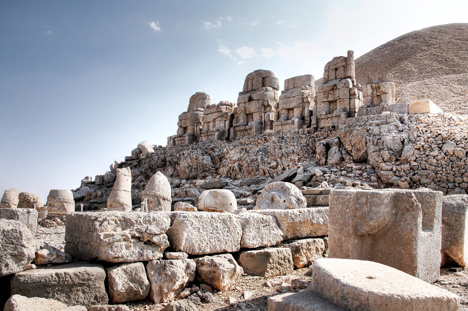
Commagene provides several of the province’s major ancient sites. At Nemrut Dağı, King Antiochos I commissioned a temple-tomb complex for himself. UNESCO dates his reign to 69–34 BCE. The monument therefore belongs to a named ruler.
UNESCO describes Nemrut’s mound of broken stone as 145 metres in diameter and 50 metres high. These measurements give you a concrete sense of its scale. Nemrut Dağı entered the UNESCO World Heritage List in 1987, adding a modern milestone to the monument’s ancient history.
Perre offers another setting for understanding Commagene. Located in Örenli, within central Adıyaman, it was one of the kingdom’s five major cities. Its position within the modern city connects the history of Commagene directly with Adıyaman’s present urban geography.
Arsameia served as Commagene’s summer administrative centre. It lies 26 kilometres from Kâhta and contains a monumental tomb area built for Mithridates I Kallinikos. Its administrative role adds another dimension to a landscape often described through royal tombs.
At Karakuş in Kâhta, Mithridates II commissioned a monumental tomb for his mother, Isias. Other women of the royal family were subsequently buried there. Karakuş thus preserves a different part of Commagene’s royal history from the complex Antiochos I commissioned for himself at Nemrut.
Roman bridges and the question of earlier settlement
Cendere Bridge was built across the Cendere stream during the reign of Septimius Severus, dated to 193–211 CE. The builders were the XVI Legion, stationed at Samsat. The bridge connects a surviving structure with both an emperor’s reign and a named military unit.
According to the Culture Portal, Cendere Bridge measures 120 metres long and 7 metres wide. It consists of one main arch and one relief arch. Another Roman bridge, Göksu Bridge, stands between Gümüşkaya and Ağcin villages. It rests on rock where the Göksu stream narrows.
Earlier settlement requires more cautious dating. The Culture Portal places Palanlı Cave 10 kilometres north of Adıyaman and reports an estimated use around 40,000 BCE. That date is an estimate. It should not become a precise foundation date for the city.
Ankara University teaching material records different scholarly dates for the rock pictures at Palanlı. It also states that the decorated rock face introduced in 1938 could not subsequently be located. These details make a single, certain date for the pictures inappropriate.
Mosques, markets, and everyday life
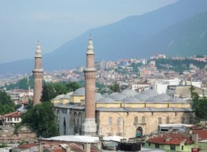
The first building of Adıyaman Ulu Camii dates to the early sixteenth century, during the Dulkadiroğulları period. Its inscriptions record rebuilding in 1863 and repairs in 1902. The mosque’s history therefore includes successive building campaigns, rather than a single construction date.
Eskisaray Camii presents another dating question. An academic study of its entrance inscription dates the building to 1148 in the Hijri calendar, corresponding to 1735–1736. The study identifies the 1638 date found in some publications as incorrect. Here, the inscription supplies the basis for correcting a repeated claim.
For an everyday-life connection, consider Oturakçı Pazarı in central Adıyaman. The historic market sells local woven goods, including carpets, kilims, cicim, and saddlebags. If you usually connect history with royal monuments, these textiles bring the subject closer to household objects and ordinary purchases.
Tuz Hanı stands within the market. According to information Governor Osman Varol gave Anadolu Agency, it was built in the late 1800s and restored in 2019. Parts collapsed during the earthquakes of 6 February 2023. An Anadolu Agency report dated 6 December 2025 stated that restoration work was continuing.
Timeline
- 69–34 BCE: Reign of Antiochos I, according to UNESCO.
- 193–211 CE: Construction of Cendere Bridge during the reign of Septimius Severus.
- 1066: Gümüştegin captures Hısnımansur.
- Early sixteenth century: First construction of Ulu Camii during the Dulkadiroğulları period.
- 1735–1736: Construction date of Eskisaray Camii according to its entrance inscription.
- 1837: Ainsworth visits and uses the name Adıyaman.
- 1863: Ulu Camii is rebuilt.
- 1926 / late 1928: Different dates given for the official change from Hısnımansur to Adıyaman.
- 14 June 1954: Law No. 6418 establishing Adıyaman province is adopted.
- 1 December 1954: The law takes effect.
- 1978: Museum activity begins with excavation finds stored in the Provincial Public Library.
- 1982: The museum moves into its own building.
- 1987: Nemrut Dağı enters the UNESCO World Heritage List.
- 2019: Tuz Hanı is restored.
- 6 February 2023: Earthquakes cause parts of Tuz Hanı to collapse.
- 14 February 2023: The Handshake Scene from Karakuş is transferred to Adıyaman Museum.
Further historical details
Perre’s water received praise in ancient sources. The Culture Portal also states that its Roman Fountain continues to be used. Alongside Perre’s place among Commagene’s five major cities, the fountain provides a specific connection between ancient water infrastructure and continued use.
At Arsameia, a stepped rock tunnel begins beneath the Greek inscription. It extends approximately 158 metres. Its purpose has not been determined. The tunnel’s approximate length is reported in the Culture Portal account; an explanation of its original function remains uncertain.
Cendere Bridge once had a fourth column dedicated to Geta. It was removed after his brother Caracalla had him killed, as part of the attempt to erase Geta’s memory. The missing column therefore belongs to the bridge’s history as much as its surviving arches do.
Adıyaman’s museum activity began in 1978, when finds from rescue excavations associated with the Lower Euphrates Project were stored in the Provincial Public Library. The museum moved into its own building in 1982. Its institutional beginnings were tied directly to the care of excavated objects.
When did Adıyaman become a province?
Adıyaman belonged to Malatya province before becoming a separate province in 1954. Law No. 6418 was adopted on 14 June and published on 22 June. It entered into force on 1 December 1954. These are separate stages in the same administrative change.
Heritage protection continued after the 2023 earthquakes. Following claims that Karakuş’s Handshake Scene had been stolen, the Ministry of Culture and Tourism stated that specialists had transferred it to Adıyaman Museum on 14 February.
FAQ
What was Adıyaman called before?
Its former official name was Hısnımansur, meaning “Mansur’s castle” in Arabic. Sources disagree over which Mansur the name commemorates.
Where does the name Adıyaman come from?
Its origin is uncertain. Luwian Adaumana, Yaman Bey, and Vadi-i Leman are alternative explanations, while Yediyaman is a legend about seven brothers.
When did Adıyaman become a separate province?
Law No. 6418 was adopted on 14 June 1954 and took effect on 1 December 1954. Adıyaman previously belonged to Malatya province.
Why is Nemrut Dağı important to Adıyaman’s history?
It contains the temple-tomb complex commissioned by Antiochos I of Commagene for himself. UNESCO dates his reign to 69–34 BCE and listed the site as World Heritage in 1987.
Sources
- TDV İslâm Ansiklopedisi — Adıyaman islamansiklopedisi.org.tr
- Turkish Wikipedia — Adıyaman tr.wikipedia.org
- Adıyaman Provincial Directorate of Culture and Tourism — Legends adiyaman.ktb.gov.tr
- Adıyaman Special Provincial Administration — History adiyamanozelidare.gov.tr
- Wikipedia — Adıyaman Province en.wikipedia.org
- TBMM — Law No. 6418 www5.tbmm.gov.tr
- Culture Portal — Palanlı Cave kulturportali.gov.tr
- Ankara University Open Courses — Prehistory of Türkiye, Adıyaman Area acikders.ankara.edu.tr
- UNESCO World Heritage Centre — Nemrut Dağ whc.unesco.org
- Culture Portal — Perre Ancient City kulturportali.gov.tr
- Culture Portal — Arsameia kulturportali.gov.tr
- Culture Portal — Karakuş Tumulus kulturportali.gov.tr
- Culture Portal — Cendere Bridge kulturportali.gov.tr
- Adıyaman Provincial Directorate of Culture and Tourism — Bridges adiyaman.ktb.gov.tr
- Culture Portal — Adıyaman Ulu Camii kulturportali.gov.tr
- Adıyaman University Journal of Social Sciences — Bacini as Decorative Elements in Adıyaman Mosques dergipark.org.tr
- Culture Portal — Oturakçı Pazarı kulturportali.gov.tr
- Anadolu Agency — Restoration of Historic Tuz Hanı aa.com.tr
- Adıyaman Provincial Directorate of Culture and Tourism — Museum adiyaman.ktb.gov.tr
- Anadolu Agency Fact Check — Claim Concerning the Karakuş Handshake Scene aa.com.tr
Image: Mount Nemrut – East Terrace (4961323529).jpg — Klearchos Kapoutsis from Santorini, Greece, CC BY 2.0