Diyarbakır history in brief
Diyarbakır stands on a plateau about 650 metres high. The plateau lies on the right bank of the Tigris, in the upper Tigris basin. That position explains much of the city’s story. You have water below and a defensible height above.
The human story here starts well before any city. Çayönü Tepesi lies in Ergani, a district of Diyarbakır province. Settlement there began about 12,000 years ago, and the site is one of the main research areas for the region’s Neolithic past. Excavations began in 1964 under Halet Çambel and Robert John Braidwood.
The city centre has its own early layers. In 2024 the excavation team at Amida Höyük found a cylinder seal. They dated it to about 5,000 years ago, to the Late Uruk period. A seal like this is a small object, but it shows that people lived and worked on this spot long before the walls you see today.
Later centuries brought new rulers. The city suffered Sasanian invasions in 359 and 502. In 639 it passed to the Muslim Arab armies. On 10 September 1515 it entered Ottoman administration, once the Safavid siege was lifted by the arrival of Ottoman troops.
The origin of the name Diyarbakır
The city has carried several names. Among the historical ones are Amida, Amid, Kara Amid and Diyarbekir. The modern name is the last step in that chain.
Start with the oldest, Amida. Its origin is not known with certainty. Scholars have not settled the question, so it is better to leave it open than to repeat a neat story.
Diyarbekir is clearer. It comes from Diyâr Bekr, a phrase for the lands where the Bekir bin Vâil tribe spread around the Tigris. Sources show Diyâr-ı Bekr from the eighth century. At first it named the region. After the seventeenth century it also came to mean the city itself.
Then came the change to Diyarbakır. A Council of Ministers decision of 10 December 1937 turned Diyarbekir into Diyarbakır. During the naming work of 1937, some people argued that the name came from the copper mine (bakır means copper in Turkish). The historical name, though, is explained by the Bekr tribe. That is how the Encyclopaedia of Islam of the Turkish Religious Foundation (TDV) explains it.
Here is the everyday link. The next time you see “Diyarbakır” on a road sign or a bus ticket, you are reading the 1937 spelling of a name that began as the land of a tribe.
Diyarbakır walls history
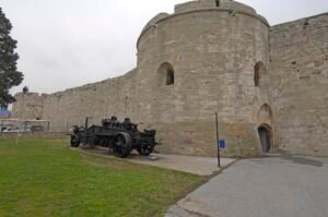
The walls are the first thing most visitors want to see. UNESCO describes them as about 5.8 kilometres long. They surround the old city on its plateau above the Tigris.
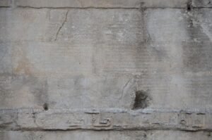
They are not a single-period build. UNESCO notes 63 inscriptions on them, from different historical periods. Walk along them and you are reading layers, not one date.
The walls were also damaged. According to UNESCO’s evaluation, a section was demolished in 1930. Keep that in mind when you notice gaps or rebuilt stretches.
The walls did not stand alone. The Hevsel Gardens ran between the walls and the Tigris. Throughout history this area supplied the city with food and water. A walled city needs a kitchen garden, and here it lay right beside the river.
In 2015 UNESCO listed the Diyarbakır Fortress and Hevsel Gardens Cultural Landscape. The listing covers both the stone and the gardens, and it treats them as one landscape.
Diyarbakır historical places
You can spend several days inside the walls. These are the places that carry the most dated evidence.
Great Mosque (Ulu Cami). The Culture Portal links its beginning to 639, when the Church of Mar Toma was turned into a mosque. Columbia University dates the present building mainly to the late eleventh and twelfth centuries. The Malik-Shah inscription carries the date Hijri 484, which is 1091-1092 in the Gregorian calendar.
Sheikh Mutahhar Mosque. The Akkoyunlu ruler Sultan Qasim had it built in 1500. Its square-plan minaret stands on four columns, separate from the mosque itself.
Behram Paşa Mosque. According to its door inscription, construction began in 1564. The building was completed in 1572.
Ten-Eyed Bridge (On Gözlü Köprü). The bridge crosses the Tigris. It is about 180 metres long and 7-8 metres wide. Its date is debated. The provincial culture and tourism directorate presents the present parts as built in 1065. The Culture Portal reports the view that the 1064-1065 inscription describes the repair of an older bridge.
Hasan Paşa Han. It stands opposite the Great Mosque. Hasan Paşa, son of Sokullu Mehmed Paşa, had it built between 1572 and 1575.
Deliller Han. Hüsrev Paşa had it built in 1527. The name refers to the guides who accompanied pilgrims heading to the Hejaz and stayed here.
Sülüklü Han. An architectural study in Belleten dates it to about 1680. For Diyarbakır inns without a known building date, the study relies on foundation records and architectural features.
Yanık Çarşı. This market inside the walls has a stone, vaulted structure. Its narrow, covered corridors show the city’s traditional trading fabric.
Cahit Sıtkı Tarancı House. The house, built in 1733, is where the poet was born. The Ministry of Culture bought it and restored it. It opened as a museum on 29 October 1973.
Cemil Paşa Mansion. The Culture Portal inventory records 1887 as its construction date. It is built of cut basalt.
Timeline
- About 12,000 years ago Neolithic settlement begins at Çayönü Tepesi near Ergani.
- Late Uruk period: the cylinder seal found at Amida Höyük in 2024 is dated to this time.
- 359 and 502 the city suffers Sasanian invasions.
- 639 the city passes to the Muslim Arab armies.
- 1064-1065 the date on the inscription of the Ten-Eyed Bridge.
- 1091-1092 the Malik-Shah inscription is set in the Great Mosque.
- 1500 Sultan Qasim builds the Sheikh Mutahhar Mosque.
- 10 September 1515 the city enters Ottoman administration.
- 1527 Hüsrev Paşa builds Deliller Han.
- 1564-1572 Behram Paşa Mosque is built.
- 1572-1575 Hasan Paşa Han is built.
- 1733 the house that later becomes the Cahit Sıtkı Tarancı Museum is built.
- 1887 the inventory date of the Cemil Paşa Mansion.
- 1930 a section of the walls is demolished.
- 10 December 1937 Diyarbekir officially becomes Diyarbakır.
- 29 October 1973 the Cahit Sıtkı Tarancı House opens as a museum.
- 2015 the fortress and Hevsel Gardens join the UNESCO World Heritage List.
Details you won’t find in guidebooks
- 63 inscriptions. UNESCO’s description of the site says the walls carry 63 inscriptions from different periods. Few visitors count them, but they make the walls a written record.
- A missing section. UNESCO’s assessment says part of the walls was demolished in 1930. The circuit you walk today is not the whole original line.
- Reused stone. Some decoration on the Great Mosque sits on reused Roman and Byzantine building fragments. Look closely at the carved pieces and you may be looking at older buildings.
- A badge from Gallipoli. In 2024 Dicle University announced that a badge linked to the Gallipoli campaign (Çanakkale) was found during the Amida Höyük excavations. Small finds like this connect the mound to events far from the ancient layers.
- A minaret on four legs. At the Sheikh Mutahhar Mosque, the minaret is not attached to the mosque. It rests on four columns of its own.
FAQ
Why is the city called Diyarbakır?
The name Diyarbekir comes from Diyâr Bekr, the lands where the Bekir bin Vâil tribe spread around the Tigris. A Council of Ministers decision of 10 December 1937 turned Diyarbekir into the form Diyarbakır.
What was Diyarbakır called before?
Historical names include Amida, Amid, Kara Amid and Diyarbekir. The origin of Amida is not known with certainty.
How long are the Diyarbakır walls?
UNESCO describes the walls as about 5.8 kilometres long. They carry 63 inscriptions from different periods.
When did Diyarbakır become Ottoman?
The city came under Ottoman administration on 10 September 1515, after Ottoman troops arrived and the Safavid siege was lifted.
Is Diyarbakır a UNESCO World Heritage Site?
Yes. The Diyarbakır Fortress and Hevsel Gardens Cultural Landscape was inscribed on the World Heritage List in 2015.
Sources
- TDV İslâm Ansiklopedisi — Diyarbakır islamansiklopedisi.org.tr
- Vikipedi — Diyarbakır tr.wikipedia.org
- Diyarbakır İl Kültür ve Turizm Müdürlüğü — Genel Bilgiler diyarbakir.ktb.gov.tr
- Çayönü Tepesi Kazı ve Araştırma Projesi cayonutepesi.org.tr
- Euronews — Diyarbakır’daki Amida Höyük’te 5.000 yıllık mühür bulundu tr.euronews.com
- UNESCO — Diyarbakır Fortress and Hevsel Gardens Cultural Landscape whc.unesco.org
- Kültür Portalı — Diyarbakır Ulu Cami kulturportali.gov.tr
- Hacettepe Üniversitesi Türkiyat Araştırmaları — Melikşah’ın Diyarbakır Ulu Camii’deki Kitabesi dergipark.org.tr
- Museum With No Frontiers — Great Mosque islamicart.museumwnf.org
- Diyarbakır İl Kültür ve Turizm Müdürlüğü — Cami ve Kiliseler diyarbakir.ktb.gov.tr
- TDV İslâm Ansiklopedisi — Behram Paşa Camii islamansiklopedisi.org.tr
- Kültür Portalı — Dicle Köprüsü kulturportali.gov.tr
- Diyarbakır Valiliği — Hasan Paşa Hanı diyarbakir.gov.tr
- Diyarbakır İl Kültür ve Turizm Müdürlüğü — Hanlar, Kervansaraylar diyarbakir.ktb.gov.tr
- Belleten — Diyarbakır’da Osmanlı Dönemi Şehir-İçi Hanları Üzerine Değerlendirme belleten.gov.tr
- Millî Eğitim Bakanlığı — Diyarbakır Yanık Çarşı okuldisiogrenme.eba.gov.tr
- Kültür ve Turizm Bakanlığı — Cahit Sıtkı Tarancı Evi Etnografya Müzesi muze.gov.tr
- Kültür Portalı — Cemil Paşa Konağı kulturportali.gov.tr
- Dicle Üniversitesi — Artuklu Sarayı Kazısından Çanakkale Gazisine Ait Rozet Bulundu dicle.edu.tr
Image: Diyarbakir city walls DSCF9396.jpg — R Prazeres, CC BY-SA 4.0