What is the Bermuda Triangle?
The Bermuda Triangle is the popular name for a stretch of the western North Atlantic. It is described as the sea between Miami, Bermuda and San Juan in Puerto Rico. Turkish Wikipedia files it under urban legends. It defines the Triangle as a story that links ship and aircraft losses in the Atlantic to one patch of ocean.
The name is younger than you might think. Vincent Gaddis used “Bermuda Triangle” in February 1964. The phrase appeared in his article “The Deadly Bermuda Triangle” in Argosy magazine. The losses existed before that. The brand did not.
If you have ever searched for the Bermuda Triangle mystery, you have met the two sides of this story. One side says ships and planes vanish without cause. The other side, represented by agencies such as NOAA, says the record does not support that. This article walks through both, using only official and documented sources.
Where is the Bermuda Triangle located?
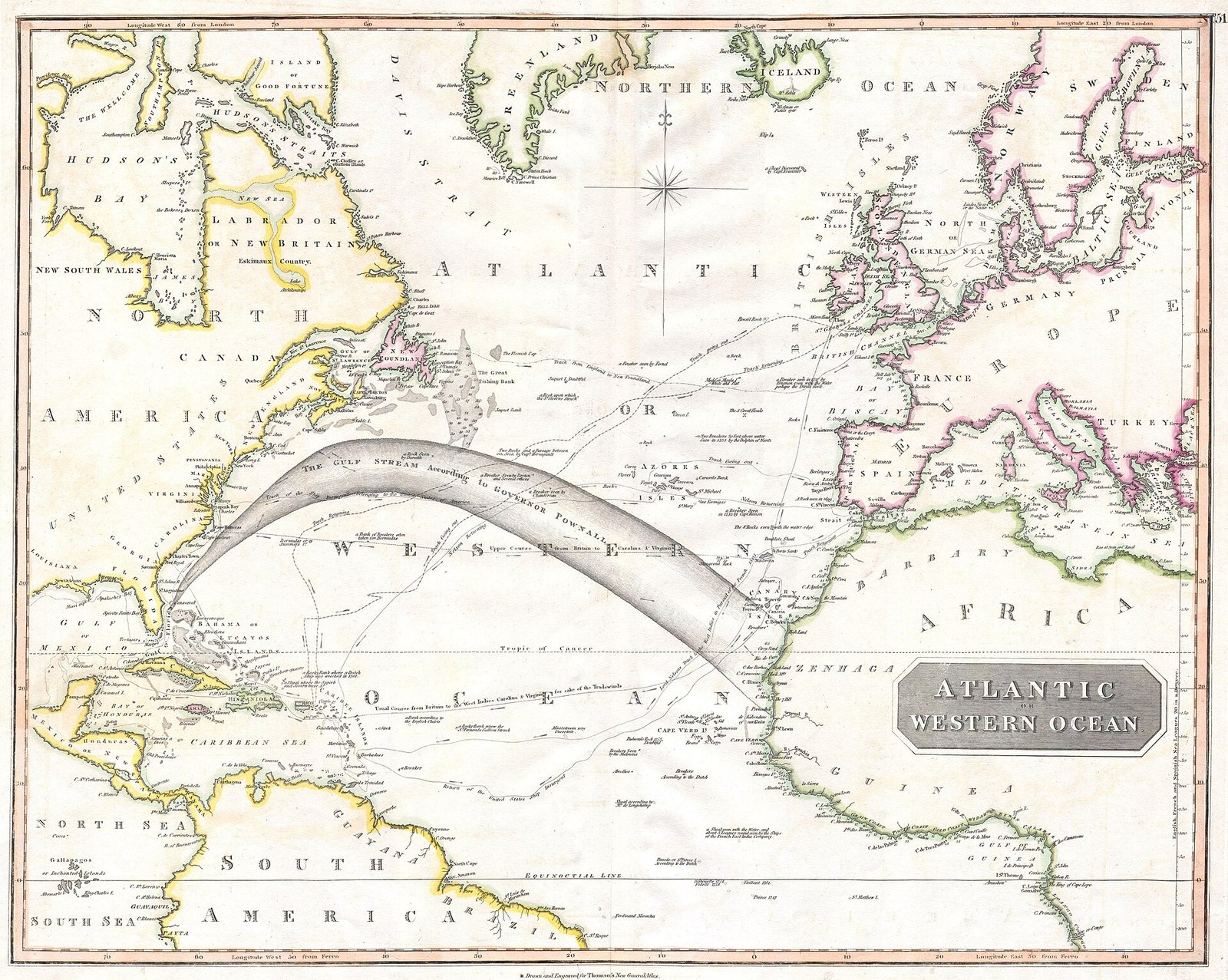
Draw three points on a map. Miami on the coast. Bermuda out in the Atlantic. San Juan on Puerto Rico. Connect them. That triangle is the area people mean. The name comes from exactly this act of joining three corners on a chart.
The size depends on who is drawing. Different writers have used figures between roughly 1.3 million and 3.9 million square kilometres. That is a wide range. It tells you something about the subject. The Triangle has no agreed edge.
Bermuda Triangle map: why there is no official one
NOAA, the National Oceanic and Atmospheric Administration, states that no official maps set the Triangle’s borders. The US Board on Geographic Names does not officially recognize the name. So when you see a Bermuda Triangle map online, you are looking at an author’s drawing. Not a navigational chart.
NOAA’s own page carries an image. It is a map showing the approximate location of the area. Note the word approximate. Even the agency that studies the ocean draws it as a rough sketch.
Bermuda Triangle history: from a magazine article to a legend
The modern legend has a clear paper trail. Gaddis coined the name in Argosy in February 1964. Ten years later, in 1974, Charles Berlitz published a book titled The Bermuda Triangle. That book is credited with spreading the supernatural version of the story.
The pushback came fast. In 1975 Larry Kusche published The Bermuda Triangle Mystery: Solved. He argued that some accounts left out the storms that were raging at the time of a loss. He also argued that some of the cases counted as Triangle losses happened outside the Triangle.
Think of how a rumor travels through a family group chat. The boring details drop out with each forward. The weather report disappears. The location gets fuzzy. By the fifth retelling, a ship lost in a hurricane becomes a ship that vanished on a calm sea. Kusche’s book is, in effect, a search for the original message.
Flight 19: the case that started it all
On 5 December 1945, five TBM Avenger aircraft took off from Fort Lauderdale on a training flight. The group was called Flight 19. It carried 14 people. None of the planes returned.
A PBM Mariner aircraft was sent to search for them. It did not return either. The two events of that single day cost 27 lives. The Mariner alone carried 13 people.
The Naval History and Heritage Command (NHHC) reviewed the case in 2021. Its conclusion is sober. No verified trace of the five aircraft or of the 14 people aboard has ever been found. The NHHC considers disorientation, fuel exhaustion and a forced landing on the sea in worsening weather to be likely explanations. It also states plainly that the definitive cause of the loss has not been established.
The Mariner has its own probable story. The NHHC finds it likely that the aircraft suffered an in-flight fire linked to fuel vapor. Again, the exact cause is not confirmed.
USS Cyclops: the Navy’s unsolved loss
The other anchor case is older. USS Cyclops disappeared in 1918 while sailing from Barbados to Baltimore. The US Naval Institute revisited the case in 2021. Its assessment is that the fate of the ship remains unsolved.
Two unsolved cases, decades apart, give the legend its weight. Neither has a confirmed answer. That is a fact. Whether an unanswered question equals a supernatural one is a different matter.
Bermuda Triangle explained: what NOAA says
NOAA’s position is direct. There is no evidence that mysterious disappearances happen more often in the Bermuda Triangle than in any other large, heavily traveled stretch of ocean.
NOAA does list physical hazards. Tropical storms and hurricanes in the Atlantic can explain maritime accidents. The Gulf Stream is linked to rapid weather changes. The shallows around the Caribbean islands are navigational dangers. Put busy traffic, fast-changing weather and shallow water together, and accidents follow.
NOAA also reports the view of the US Navy and the US Coast Guard. Their assessment does not support supernatural explanations.
The theories: Atlantis, aliens and methane
Over the years, the losses have been tied to Atlantis, to aliens and to vortices between dimensions. NOAA notes these claims and notes that the Navy and Coast Guard assessment does not back them.
The methane theory is the one that sounds scientific. Experiments have shown that methane bubbles can reduce the density of water and sink a vessel. TÜBİTAK’s science outlet reports this. It does not present methane as a proven common cause of Bermuda accidents.
The methane hydrate version faces a harder problem. According to a US Geological Survey assessment cited by English Wikipedia, no large releases are thought to have occurred in the region in the last 15,000 years. A mechanism that works in a tank is not the same as a mechanism that happened at sea.
Bermuda Triangle movies and documentaries
The American Film Institute records Donald Brittain’s Secrets of the Bermuda Triangle as released on 20 July 1978.
Bermuda Triangle pictures and videos: what is real?
The documented visual record in official sources is small. NOAA’s page offers a map of the approximate area. The NHHC’s Flight 19 page uses photo NH 91350. The NHHC describes it as an archive image showing the same type of TBM Avenger as the lost aircraft.
That is the honest inventory. A map and an archive photo of an aircraft type. Any image that claims to show the moment of a disappearance is not among the sources here.
Timeline
- 1918 USS Cyclops is lost on a voyage from Barbados to Baltimore.
- 5 December 1945 Five Avenger aircraft of Flight 19 and one PBM Mariner search plane are lost.
- February 1964 Vincent Gaddis uses the name Bermuda Triangle in Argosy magazine.
- 1974 Charles Berlitz publishes The Bermuda Triangle.
- 1975 Larry Kusche publishes The Bermuda Triangle Mystery: Solved.
- 2021 The NHHC’s H-057-4 review weighs natural explanations for Flight 19 and lists what remains unknown.
Details you won’t find in guidebooks
- The leader of Flight 19, Charles C. Taylor, had logged 2,509.3 flight hours. This was not an inexperienced pilot.
- All five aircraft were missing their 24-hour clocks. Pilots were expected to carry wristwatches, so the flight went ahead. It is a bit like leaving on a road trip with a dead dashboard clock and trusting your phone.
- A Marine named Allan Kosnar asked to be excused from the 5 December 1945 flight. He was not aboard the lost aircraft.
- The tanker SS Gaines Mills reported a burst of flame at 19:50 on the evening the search aircraft vanished. It also found an oil slick in the area.
FAQ
Where is the Bermuda Triangle located?
It is the area of the western North Atlantic described between Miami, Bermuda and San Juan in Puerto Rico. NOAA notes that no official map fixes its borders, and the US Board on Geographic Names does not recognize the name.
Is the Bermuda Triangle mystery real?
Individual cases such as Flight 19 in 1945 and USS Cyclops in 1918 remain without a confirmed cause. However, NOAA states there is no evidence that mysterious disappearances happen more often there than in other large, heavily traveled sea areas.
What happened to Flight 19?
Five TBM Avenger aircraft with 14 people left Fort Lauderdale on a training flight on 5 December 1945 and never returned. A PBM Mariner sent to search for them was also lost with 13 people. The Naval History and Heritage Command considers disorientation, fuel exhaustion and ditching in worsening weather likely, but no definitive cause has been established.
Are there real Bermuda Triangle photos?
The documented images in official sources are modest. NOAA’s page shows a map of the approximate location. The Naval History and Heritage Command’s Flight 19 page uses photo NH 91350, an archive image of the same aircraft type as the lost planes.
Sources
- NOAA, What is the Bermuda Triangle? oceanservice.noaa.gov
- Naval History and Heritage Command, The Loss of Flight 19 history.navy.mil
- Naval History and Heritage Command, H-057-4 history.navy.mil
- Naval History and Heritage Command, H-Gram 057 (PDF) history.navy.mil
- U.S. Naval Institute, USS Cyclops: Deadliest Unsolved Mystery in Navy History usni.org
- TÜBİTAK Bilim Genç, Bermuda Şeytan Üçgeni: Efsane mi Gerçek mi? bilimgenc.tubitak.gov.tr
- English Wikipedia, Bermuda Triangle en.wikipedia.org
- Turkish Wikipedia, Bermuda Şeytan Üçgeni tr.wikipedia.org
Image: 1814 Thomson Map of the Atlantic Ocean – Geographicus – Atlantic-t-1814.jpg — John Thomson, Public domain