Where is Ani?
Ani lies in the Merkez district of Kars province. It stands west of the Arpaçay River, which forms the border between Türkiye and Armenia. UNESCO places it 42 kilometres from the Kars city centre. It describes the site as a triangular plateau surrounded by natural valleys.
The UNESCO file gives the coordinates as 40°30′ north and 43°34′ east. If you plan a visit, that is the spot to put on your map. Across the river you can see the other bank, because the border runs through the same valley.
The World Heritage area covers 250.7 hectares. A buffer zone of 432.45 hectares surrounds it. Both numbers come from UNESCO.
A city that began on a volcanic rock
Settlement inside the walls began in the 4th century CE. According to the Turkish Culture Portal, it started in the Inner Fortress. The Ministry of Culture and Tourism says the Inner Fortress sits on a layer of volcanic tuff. It occupies the highest part of the site.
People lived here long before the walls. Prehistoric settlements were in volcanic caves in the valley of the Bostanlar Creek. So the story of Ani starts in holes in the rock, not in marble halls.
From a capital to a Silk Road giant
In 961, the Bagratuni king Ashot III moved his capital to Ani. He launched a large building programme in the city. Ani served as the capital of the Bagratuni Armenian Kingdom from 961 to 1045.
Money followed power. Ani grew rich in the 10th and 11th centuries partly because it controlled a branch of the Silk Road. Think of a town beside a busy motorway junction today. Petrol stations, cafés and shops all depend on the traffic. Ani worked in much the same way, only with caravans instead of lorries.
The walls tell you how serious the city was. The Ministry’s museum page gives their length as about 4,500 metres and their height as 8 metres. Walk the line and you start to feel the scale.
Was it really the City of 1,001 Churches?
The nickname is famous. It is also a nickname and nothing more. English Wikipedia states that the actual number of churches was well below 1,001. Treat the figure as a poetic way to say “very many”, not as a count.
The population is debated too. Some estimates put Ani at around 100,000 people. Some historians question this. They argue that the city’s limited area could not have held that many.
So be careful with big numbers when you read about Ani. The walls, the buildings and the dates are solid. The round figures are not.
Byzantines, then Alparslan
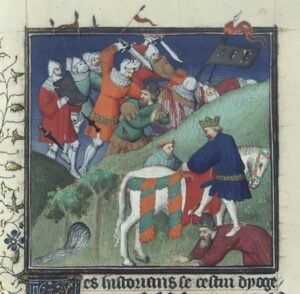
In 1045, Ani passed to Byzantine rule. It stayed under that rule until 1064. On 16 August 1064, the Seljuk sultan Alparslan conquered the city.
The change of rulers left marks you can still read in the stone. The best example is the cathedral.
The cathedral that became a mosque
Ani Cathedral is built of red tuff stone. After the conquest of 1064 it was converted into a mosque. That is why it is also called the Fethiye Mosque, the “Conquest” Mosque.
The usual date for its completion is 1001. English Wikipedia adds that an alternative reading of the building’s inscription gives 1010. Scholars do not fully agree.
Here is a detail you will rarely see in a guidebook. The cathedral’s architect was Tiridat. The Ministry notes that he also worked on the repair of Hagia Sophia in Istanbul. One man, two of the great buildings of the medieval world.
The mosque of Manuchihr
The three-aisled Abu’l Manuchihr Mosque is another landmark. The Ministry says the Shaddadid emir Ebul Şüca Manuçehr had it built in 1072. That is only eight years after Alparslan’s conquest.
The same Manuchihr appears on a gate. The Middle Gate of Ani is also called the Lion Gate. It carries a relief of a lion and an inscription ordered by Manuchihr.
In 1906, the mosque was partly repaired. The aim was to house the finds of Nikolai Marr’s excavations in a museum. A building from the 11th century thus became a museum in the early 20th.
Tigran Honents and the merchant’s church
Not every great building came from a king. The Church of Tigran Honents was completed in 1215. It was sponsored by Tigran Honents, a wealthy Armenian merchant. It shows that Ani’s trade money kept paying for monuments long after the Bagratuni kings were gone.
The Silk Road Bridge
The Silk Road Bridge crosses the Arpaçay on the border between Türkiye and Armenia. Today you see the piers on both banks, along with traces of the footpaths. The span itself has not survived.
The Culture Portal notes that the bridge had two levels. Caravans used the lower level. Pedestrians and soldiers used the upper one. It was a traffic system with separate lanes.
Why Ani fell silent
UNESCO ties the decline of Ani to three things: the Mongol invasion, the earthquake of 1319 and the change in trade routes. When the caravans took other roads, the city lost its reason to exist. By the 18th century, UNESCO says, Ani was almost completely abandoned.
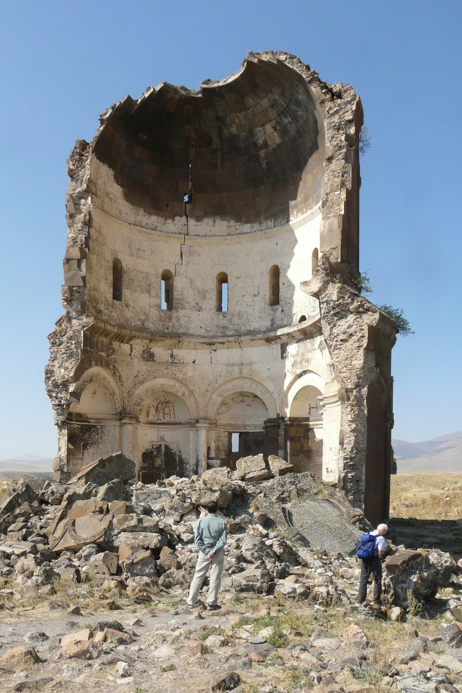
The ruins also kept losing buildings in modern times. The eastern half of the Church of the Holy Redeemer (Surp Prkiç) did not fall in the Middle Ages. It collapsed during a storm in 1955.
Digging up Ani
Nikolai Yakovlevich Marr excavated at Ani in 1892–1893 and again from 1904 to 1917. Work has continued in our own time. In the 2024 season, a team of 35 people from 10 universities worked at eight points. The excavation was led by Muhammet Arslan.
In 2016, the Archaeological Site of Ani was inscribed on the UNESCO World Heritage List. It met cultural criteria (ii), (iii) and (iv).
Timeline
- 4th century CE: Settlement inside the walls begins in the Inner Fortress.
- 961 Ashot III moves his capital to Ani.
- 1045 Ani passes to Byzantine rule.
- 16 August 1064 Alparslan conquers Ani.
- 1072 The Abu’l Manuchihr Mosque is built, according to the Ministry.
- 1215 The Church of Tigran Honents is completed.
- 1319 A destructive earthquake contributes to the city’s decline.
- 18th century UNESCO describes the city as almost completely abandoned.
- 1892–1893 Nikolai Marr’s first excavation period.
- 1906 The Abu’l Manuchihr Mosque is partly repaired for a museum of excavation finds.
- 1955 The eastern half of the Surp Prkiç church collapses in a storm.
- 2016 Ani is inscribed on the UNESCO World Heritage List.
- 2024 Excavations run at eight points with a team of 35 people from 10 universities.
Details you won’t find in guidebooks
- The first people at Ani lived in volcanic caves in the Bostanlar Creek valley, not inside the walled city.
- Tiridat, the architect of Ani Cathedral, also worked on the repair of Hagia Sophia in Istanbul.
- In 1906, a mosque was partly restored to become a museum for Nikolai Marr’s finds.
- The eastern half of the Surp Prkiç church fell in 1955, in a storm, not in the Middle Ages.
- The Silk Road Bridge had two levels. Caravans used the lower one. Pedestrians and soldiers used the upper one.
FAQ
Where is Ani?
Ani is in the Merkez district of Kars province, west of the Arpaçay River. The river forms the border between Türkiye and Armenia. UNESCO gives the distance from the Kars city centre as 42 kilometres.
Did Ani really have 1,001 churches?
No. “The City of 1,001 Churches” is a nickname. English Wikipedia notes that the real number of churches was well below that figure.
When did Ani become a UNESCO World Heritage Site?
In 2016. The Archaeological Site of Ani was inscribed under cultural criteria (ii), (iii) and (iv).
Who ruled Ani over the centuries?
The Bagratuni Armenian Kingdom made it a capital from 961 to 1045. Byzantine rule followed until 1064, when the Seljuk sultan Alparslan took the city on 16 August.
Why did Ani decline?
UNESCO links the decline to the Mongol invasion, the earthquake of 1319 and the shifting of trade routes. By the 18th century the city was almost completely abandoned.
Sources
- UNESCO — Archaeological Site of Ani whc.unesco.org
- Kültür Portalı — Ani Arkeolojik Alanı kulturportali.gov.tr
- Kültür ve Turizm Bakanlığı — Ani Örenyeri muze.gov.tr
- Kültür Portalı — İpek Yolu Köprüsü kulturportali.gov.tr
- Anadolu Ajansı — Ani Ören Yeri’nde yeni sezonun kazı çalışmalarına başlandı aa.com.tr
- English Wikipedia — Ani en.wikipedia.org
- Türkçe Vikipedi — Ani tr.wikipedia.org
Image: Türkei, historische Stadt Ani, Erlöserkirche.jpg — Feldstein, CC BY-SA 4.0