Antibes was called Antipolis because its Greek name, Ἀντίπολις, means “the city opposite.” What it stood opposite remains disputed: explanations point to Nice, Corsica or the indigenous settlement on the Rocher, but none is generally accepted.
A name suggesting an opposite shore suits a settlement connected to maritime routes. Yet Antipolis also has a history beneath its streets: an early indigenous settlement, a Roman trading ship and water pipes from an affluent house. If you follow those traces, the story leads from a Greek colony to the fortified town whose Saint-André Bastion houses an archaeological museum.
Why did the Greeks call it Antipolis?
Antibes lies in southeastern France, in the Alpes-Maritimes department of Provence-Alpes-Côte d’Azur. Its ancient name preserves a Greek description of position. The meaning of Antipolis is clear; the geographical reference behind that meaning is less certain.
One explanation places Antipolis opposite Nice, across the mouth of the Var. The regional archaeological account challenges this interpretation because Nice appears to have been founded later. That relative chronology makes it difficult to treat Nice as the settled answer to the naming question.
Other explanations connect the name with Corsica or with the indigenous village on the Rocher. Corsica also appears in the regional account of Phocaean navigation. Their maritime route followed the coast as far as Antibes before turning directly towards the island. This makes Corsica relevant to the port’s setting, without establishing the naming theory.
The Rocher offers a different reference point within Antibes itself. Near the cathedral and château, archaeologists found traces of indigenous occupation dating to the early sixth century BC. The proposed connection between that settlement and the Greek name remains one explanation among several.
Who founded Antipolis, and when?
Antipolis belonged to the Greek colonies founded by Phocaeans from Massalia, present-day Marseille. Its origins therefore connect it to a maritime network centred on Massalia. The indigenous traces on the Rocher also show that the history of settlement at Antibes extends beyond the question of the Greek colony’s foundation.
The foundation date is disputed. The department’s general historical account proposes a date between 565 and 540 BC. Its archaeological account gives no precise foundation date and instead highlights an increase in imports around the transition from the fourth to the third century BC.
These dates concern different kinds of evidence. Early sixth-century BC occupation belongs to the indigenous settlement. The proposed 565–540 BC range concerns the colony’s foundation, while the later evidence documents an increase in imports. You should keep those distinctions in mind when reading a compact history of Antipolis.
How did the harbour support Greek and Roman Antipolis?
Anse Saint-Roch provided a natural harbour sheltered from prevailing winds. It lay on the maritime route between Marseille and the Italian coast. Protection and position together help explain why this stretch of shore mattered to an ancient trading settlement.
Maritime commerce supported the prosperity of both Greek and Roman Antipolis. Fish salting and the production of garum, a fermented fish sauce, were also important activities. The port’s economy thus connected the movement of ships with the preparation of fish products.
The Antibes Archaeology Museum dates the formation of the Roman town from 49 BC. In its account, that year marks Antipolis’s release from Marseille’s tutelage. It provides a chronological marker between the colony’s Massaliote connections and the development of Roman Antipolis.
Water infrastructure formed another part of the Roman town. The Bouillide aqueduct extended approximately 16 kilometres, while the Font Vieille aqueduct measured 4.5 kilometres. Alongside the harbour and its industries, these works belong to the material history of the settlement.
What did the ancient harbour excavations reveal?
Between March and October 2012, archaeologists excavated 5,000 square metres of the ancient harbour at Pré aux Pêcheurs. The work took place before construction of an underground car park. It exposed evidence of both harbour maintenance and shipping.
A merchant ship dating to the second or third century AD was among the discoveries. Approximately 15 metres survived, and its original length was estimated at 20–22 metres. Those measurements distinguish the preserved remains from the reconstructed size of the complete vessel.
The excavation also revealed traces of dredging around the beginning of the Common Era. These appeared across a 1,500-square-metre section of the harbour and were associated with efforts to counter silting. The sheltered harbour still required intervention to keep sand from accumulating.
Timeline
- Early sixth century BC: Indigenous occupation is evidenced on the Rocher.
- Fifth century BC: The Terpon pebble inscription dates to this period.
- Turn of the fourth to third century BC: Imports increase; the colony’s foundation date remains disputed.
- 49 BC: The museum’s account marks release from Marseille’s tutelage and the beginning of the Roman town’s formation.
- Second–third centuries AD: The merchant ship discovered in 2012 belongs to this period.
- Late Antiquity: Antibes receives its first defensive enclosure.
- 1385: Marc and Luc Grimaldi receive the lordship of Antibes.
- 1481: Provence joins France, giving Antibes a frontier position.
- 1565–1585: Four bastions develop Fort Carré around the Saint-Laurent Tower; the fort becomes operational.
- 1603: Construction begins on Raymond de Bonnefons’s town walls.
- 1680: Vauban begins directing harbour and defensive improvements.
- 1698: Saint-André Bastion is built according to Vauban’s plans.
- 1700: Vauban proposes a major naval harbour project that remains unbuilt.
- 1889–1895: Fortified status ends, followed by the definitive agreement on wall demolition.
- June 1963: The Archaeology Museum opens in Saint-André Bastion.
- 2012: Excavation exposes part of the ancient harbour and the Roman merchant ship.
How did an ancient port become a fortified frontier town?
Antibes acquired its first defensive enclosure in Late Antiquity. Another circuit of walls, built during the Middle Ages, included round towers and underwent repairs around the fourteenth century. The town’s defensive history therefore began well before its later frontier role.
In 1385, the lordship of Antibes passed to the brothers Marc and Luc Grimaldi. The Grimaldis built Château Grimaldi as their residence in the town. Their lordship forms part of the medieval history between the ancient settlement and the later French stronghold.
Provence’s incorporation into France in 1481 placed Antibes on France’s southeastern frontier, facing the County of Nice under Savoy. In 1552, Henri II decided to build the Saint-Jaume Tower on the Saint-Jaume islet to watch over the harbour.
Fort Carré developed around the Saint-Laurent Tower. Four bastions were added from 1565, and the structure was operational in 1585. Construction of another major defensive scheme began in 1603: Raymond de Bonnefons’s town walls, designed with four bastions and two gates.
From 1680, Vauban ordered continued harbour works, renewed gates and improved defences. His larger proposal of 1700 would have connected the town to Fort Carré and made Antibes a naval harbour offering an alternative to Toulon. That project was never carried out.
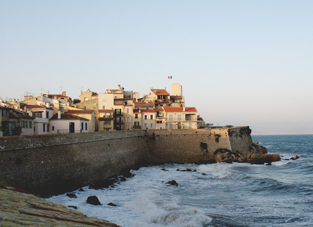
Antibes lost its status as a fortified position in 1889. The definitive agreement between the state and municipality concerning demolition of the walls followed in October 1895. Saint-André Bastion, built in 1698 according to Vauban’s plans, later became the archaeological museum.
Details you won’t find in guidebooks
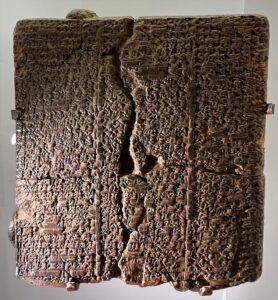
The Terpon pebble is Antibes’s oldest known inscription. Dated to the fifth century BC, it carries a Greek text associated with Aphrodite. This small object adds written evidence to the settlement’s Greek history alongside the evidence of imports.
Excavations on Rue Clemenceau between 1992 and 1994 investigated an affluent residence from the late second century AD. It contained a mosaic with hexagonal decoration, a marble fountain and lead water pipes. If you think about the water you use at home, those pipes provide an everyday connection to the Roman town.
The merchant ship recovered in 2012 had lead sheets reinforcing parts of its hull. Small nails secured the sheets in some places. Alongside the vessel’s surviving length, this detail offers a closer view of its physical construction.
Saint-André Bastion also preserves a history of food and water. Its two brick-vaulted galleries served as the garrison dining hall, and the building contained an underground cistern and four bread ovens. Since June 1963, the bastion has housed finds from excavations on land and underwater.
FAQ
What does Antipolis mean?
Antipolis, written Ἀντίπολις in Greek, means “the city opposite.” Proposed explanations connect it with Nice, Corsica or the indigenous settlement on the Rocher, but none is generally accepted.
Who founded Antipolis?
Antipolis was a Greek colony founded by Phocaeans from Massalia, present-day Marseille. Its foundation date remains disputed.
What supported the ancient port’s prosperity?
Maritime trade, fish salting and the production of fermented fish sauce called garum supported Greek and Roman Antipolis. Anse Saint-Roch provided a natural harbour sheltered from prevailing winds.
Where is the Antibes Archaeology Museum?
The museum opened in June 1963 inside Saint-André Bastion, built in 1698 according to Vauban’s plans. It displays finds from excavations on land and underwater.
Sources
- English Wikipedia — Antibes en.wikipedia.org
- Türkçe Vikipedi — Antibes tr.wikipedia.org
- Département des Alpes-Maritimes — Les traces de l’Antiquité grecque et latine portail-savoirs.departement06.fr
- Département des Alpes-Maritimes — Des origines au Xe siècle après J.C departement06.fr
- Inrap — Le port antique d’Antibes inrap.fr
- Ville d’Antibes — Découvrir le musée d’Archéologie antibes-juanlespins.com
- Inrap Images d’archéologie — Une épave romaine dans le port antique d’Antibes images-archeologie.fr
- Réseau des sites majeurs Vauban — Antibes sites-vauban.org
Image: Antibesbordmer.JPG — Gilbert Bochenek, CC BY 3.0